
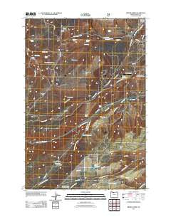
~ Brown Creek OR topo map, 1:24000 scale, 7.5 X 7.5 Minute, Historical, 2011
Brown Creek, Oregon, USGS topographic map dated 2011.
Includes geographic coordinates (latitude and longitude). This topographic map is suitable for hiking, camping, and exploring, or framing it as a wall map.
Printed on-demand using high resolution imagery, on heavy weight and acid free paper, or alternatively on a variety of synthetic materials.
Topos available on paper, Waterproof, Poly, or Tyvek. Usually shipping rolled, unless combined with other folded maps in one order.
- Product Number: USGS-5311644
- Free digital map download (high-resolution, GeoPDF): Brown Creek, Oregon (file size: 20 MB)
- Map Size: please refer to the dimensions of the GeoPDF map above
- Weight (paper map): ca. 55 grams
- Map Type: POD USGS Topographic Map
- Map Series: US Topo
- Map Verison: Historical
- Cell ID: 5689
- Datum: North American Datum of 1983
- Map Projection: Transverse Mercator
- Map Cell Name: Brown Creek
- Grid size: 7.5 X 7.5 Minute
- Date on map: 2011
- Map Scale: 1:24000
- Geographical region: Oregon, United States
Neighboring Maps:
All neighboring USGS topo maps are available for sale online at a variety of scales.
Spatial coverage:
Topo map Brown Creek, Oregon, covers the geographical area associated the following places:
- Sheep Spring - Liechti Pond Number Two - Thousand Acre Pasture - Miller Spring - Pointers Airport - Wasco Lookout - Mill Creek Falls - Slegman Spring - Dutch Flat - Mount Hood Flat - Chenoweth Airpark - Liechti Pond - Lubbing Flat - Seward Flat - Evans Dam - Blackburn Canyon - Evans Reservoir - South Fork Mill Creek - Mill Creek School (historical) - Leniger Spring - Obrist Cemetery - Ladore Creek - Wassen Pond - Cotton Spring - Chenoweth Airpark Terminal - Ketchum Pond - Mount Hood Flat School (historical) - Twin Springs - Martin Spring - Pullens Pond - Matney Post Office (historical) - Wasco Guard Station - Oak Flat - North Fork Mill Creek - The Dalles Wicks Water Treatment Plant - Brown Creek - Wasco Butte - The Dalles Division - O'Connor Spring - Coon Spring - Obrist Grade - Wetle Spring - Scheuter Spring - Dry Fork - Indian Hollow - Wicks Reservoir - Trugg Reservoir - Suicide Grade - Poe Spring - Dunnigan Spring - Lucky Canyon - Government Flat
- Map Area ID: AREA45.62545.5-121.375-121.25
- Northwest corner Lat/Long code: USGSNW45.625-121.375
- Northeast corner Lat/Long code: USGSNE45.625-121.25
- Southwest corner Lat/Long code: USGSSW45.5-121.375
- Southeast corner Lat/Long code: USGSSE45.5-121.25
- Northern map edge Latitude: 45.625
- Southern map edge Latitude: 45.5
- Western map edge Longitude: -121.375
- Eastern map edge Longitude: -121.25


