
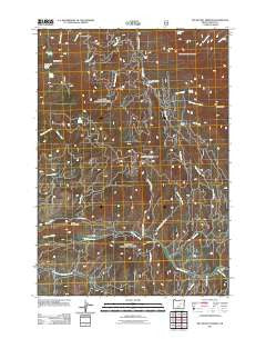
~ Big Weasel Springs OR topo map, 1:24000 scale, 7.5 X 7.5 Minute, Historical, 2011
Big Weasel Springs, Oregon, USGS topographic map dated 2011.
Includes geographic coordinates (latitude and longitude). This topographic map is suitable for hiking, camping, and exploring, or framing it as a wall map.
Printed on-demand using high resolution imagery, on heavy weight and acid free paper, or alternatively on a variety of synthetic materials.
Topos available on paper, Waterproof, Poly, or Tyvek. Usually shipping rolled, unless combined with other folded maps in one order.
- Product Number: USGS-5311580
- Free digital map download (high-resolution, GeoPDF): Big Weasel Springs, Oregon (file size: 23 MB)
- Map Size: please refer to the dimensions of the GeoPDF map above
- Weight (paper map): ca. 55 grams
- Map Type: POD USGS Topographic Map
- Map Series: US Topo
- Map Verison: Historical
- Cell ID: 3881
- Datum: North American Datum of 1983
- Map Projection: Transverse Mercator
- Map Cell Name: Big Weasel Springs
- Grid size: 7.5 X 7.5 Minute
- Date on map: 2011
- Map Scale: 1:24000
- Geographical region: Oregon, United States
Neighboring Maps:
All neighboring USGS topo maps are available for sale online at a variety of scales.
Spatial coverage:
Topo map Big Weasel Springs, Oregon, covers the geographical area associated the following places:
- Fields Peak - Chrome Ridge - Tennessee Creek - Hells Canyon Creek - Big Canyon Spring - Thorn Creek Butte - Buck Cabin Trail - Frankie and Johnny Spring - Hattie Creek - Dry Creek Butte - Little Weasel Spring - Oregon Mine - Wickiup Creek - Lemon Cabin - Last Creek - Dans Creek - Horse Creek - China Hat Spring - Beaver Creek - Hattie Spring - Buck Cabin Creek - Tex Creek Arch - Oregon Mine Camp - Big Weasel Springs - Oregon Mine Recreation Site - Last Camp - Shaw Spring - Separation Corrals Camp - Murderers Creek Forest Service Station - Billy Fields Recreation Site - Cedar Grove Botanical Area - Stewart Cabin - Orange Creek - Oregon Mine Creek - Tex Creek - Buck Cabin - Aldrich Mountains - Lemon Creek
- Map Area ID: AREA44.37544.25-119.375-119.25
- Northwest corner Lat/Long code: USGSNW44.375-119.375
- Northeast corner Lat/Long code: USGSNE44.375-119.25
- Southwest corner Lat/Long code: USGSSW44.25-119.375
- Southeast corner Lat/Long code: USGSSE44.25-119.25
- Northern map edge Latitude: 44.375
- Southern map edge Latitude: 44.25
- Western map edge Longitude: -119.375
- Eastern map edge Longitude: -119.25


