
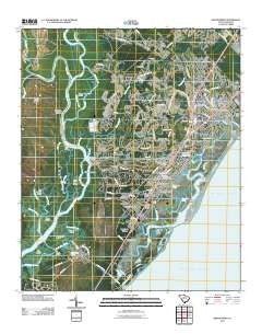
~ Brookgreen SC topo map, 1:24000 scale, 7.5 X 7.5 Minute, Historical, 2011
Brookgreen, South Carolina, USGS topographic map dated 2011.
Includes geographic coordinates (latitude and longitude). This topographic map is suitable for hiking, camping, and exploring, or framing it as a wall map.
Printed on-demand using high resolution imagery, on heavy weight and acid free paper, or alternatively on a variety of synthetic materials.
Topos available on paper, Waterproof, Poly, or Tyvek. Usually shipping rolled, unless combined with other folded maps in one order.
- Product Number: USGS-5311526
- Free digital map download (high-resolution, GeoPDF): Brookgreen, South Carolina (file size: 22 MB)
- Map Size: please refer to the dimensions of the GeoPDF map above
- Weight (paper map): ca. 55 grams
- Map Type: POD USGS Topographic Map
- Map Series: US Topo
- Map Verison: Historical
- Cell ID: 5615
- Datum: North American Datum of 1983
- Map Projection: Transverse Mercator
- Map Cell Name: Brookgreen
- Grid size: 7.5 X 7.5 Minute
- Date on map: 2011
- Map Scale: 1:24000
- Geographical region: South Carolina, United States
Neighboring Maps:
All neighboring USGS topo maps are available for sale online at a variety of scales.
Spatial coverage:
Topo map Brookgreen, South Carolina, covers the geographical area associated the following places:
- Richmond Hill - Mulberry Landing - Live Oaks - Eagle Crest - Mount Gilead - Longwood Landing - Wayside Forest - Captains Cove - Huntington Marsh - Jamestown - Seabreeze - Carriage Run - Robin Hood - Pirate Cove - Wachesaw Landing - Garden City Beach - Jensens - Windjammer Village - Garden City - Inlet Harbor - Burgess - Crystal Oaks - Murrells Inlet - Moss Creek - Inlet Oaks Village - Thompson (historical) - Sunny Side - Wachesaw Place - Blue Heron - Oak Hill - Ocean Pines
- Map Area ID: AREA33.62533.5-79.125-79
- Northwest corner Lat/Long code: USGSNW33.625-79.125
- Northeast corner Lat/Long code: USGSNE33.625-79
- Southwest corner Lat/Long code: USGSSW33.5-79.125
- Southeast corner Lat/Long code: USGSSE33.5-79
- Northern map edge Latitude: 33.625
- Southern map edge Latitude: 33.5
- Western map edge Longitude: -79.125
- Eastern map edge Longitude: -79


