
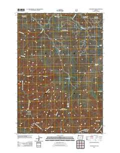
~ Silver Butte OR topo map, 1:24000 scale, 7.5 X 7.5 Minute, Historical, 2011
Silver Butte, Oregon, USGS topographic map dated 2011.
Includes geographic coordinates (latitude and longitude). This topographic map is suitable for hiking, camping, and exploring, or framing it as a wall map.
Printed on-demand using high resolution imagery, on heavy weight and acid free paper, or alternatively on a variety of synthetic materials.
Topos available on paper, Waterproof, Poly, or Tyvek. Usually shipping rolled, unless combined with other folded maps in one order.
- Product Number: USGS-5310948
- Free digital map download (high-resolution, GeoPDF): Silver Butte, Oregon (file size: 27 MB)
- Map Size: please refer to the dimensions of the GeoPDF map above
- Weight (paper map): ca. 55 grams
- Map Type: POD USGS Topographic Map
- Map Series: US Topo
- Map Verison: Historical
- Cell ID: 41359
- Datum: North American Datum of 1983
- Map Projection: Transverse Mercator
- Map Cell Name: Silver Butte
- Grid size: 7.5 X 7.5 Minute
- Date on map: 2011
- Map Scale: 1:24000
- Geographical region: Oregon, United States
Neighboring Maps:
All neighboring USGS topo maps are available for sale online at a variety of scales.
Spatial coverage:
Topo map Silver Butte, Oregon, covers the geographical area associated the following places:
- Miners Cabin - Paradise Creek - Silver Butte - Badger Creek - Forks Guard Station - South Fork Meadow Creek - Paradise Trail - Indian Trail - Moon Meadow - China Meadow - Martin Creek - Glade Creek - Trout Meadows Trail - North Fork John Day Wilderness - Squaw Creek - Ryder Creek - Faulkner Gulch - Silver Creek - Wagner Gulch Trail - Packsaddle Spring - Log Table Camp - Silver Spring Camp - Dixson Bar - Blackwell Trail - Bear Gulch - Martin Creek Trail - White Creek - McCarty Gulch - Silver Butte Trail - Meadow Creek Driveway Trail - Headquarters Camp - Wind Rock
- Map Area ID: AREA4544.875-118.625-118.5
- Northwest corner Lat/Long code: USGSNW45-118.625
- Northeast corner Lat/Long code: USGSNE45-118.5
- Southwest corner Lat/Long code: USGSSW44.875-118.625
- Southeast corner Lat/Long code: USGSSE44.875-118.5
- Northern map edge Latitude: 45
- Southern map edge Latitude: 44.875
- Western map edge Longitude: -118.625
- Eastern map edge Longitude: -118.5


