
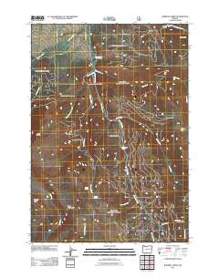
~ Roberts Creek OR topo map, 1:24000 scale, 7.5 X 7.5 Minute, Historical, 2011
Roberts Creek, Oregon, USGS topographic map dated 2011.
Includes geographic coordinates (latitude and longitude). This topographic map is suitable for hiking, camping, and exploring, or framing it as a wall map.
Printed on-demand using high resolution imagery, on heavy weight and acid free paper, or alternatively on a variety of synthetic materials.
Topos available on paper, Waterproof, Poly, or Tyvek. Usually shipping rolled, unless combined with other folded maps in one order.
- Product Number: USGS-5310944
- Free digital map download (high-resolution, GeoPDF): Roberts Creek, Oregon (file size: 25 MB)
- Map Size: please refer to the dimensions of the GeoPDF map above
- Weight (paper map): ca. 55 grams
- Map Type: POD USGS Topographic Map
- Map Series: US Topo
- Map Verison: Historical
- Cell ID: 38139
- Datum: North American Datum of 1983
- Map Projection: Transverse Mercator
- Map Cell Name: Roberts Creek
- Grid size: 7.5 X 7.5 Minute
- Date on map: 2011
- Map Scale: 1:24000
- Geographical region: Oregon, United States
Neighboring Maps:
All neighboring USGS topo maps are available for sale online at a variety of scales.
Spatial coverage:
Topo map Roberts Creek, Oregon, covers the geographical area associated the following places:
- Stanbro Reservoir - Grouse Spring Trail (historical) - Margaret Post Office (historical) - Trout Farm Recreation Site - Bogue Gulch - Crescent Creek - Strawberry Range - Goose Spring - Roberts Creek - Black Mountain Creek - Big Creek Trail - Cash Camp (historical) - Starvation Rock - Dead Horse Basin - Roberts Creek Trail (historical) - Snowshoe Creek Trail - Grouse Spring - Sunshine Flat - Rail Creek - Graham Creek - Rail Creek Trail - Little Meadows - Blue Mountain Hot Springs - Kimport Ridge - Frog Lake - Snow Creek - Crescent Recreation Site - Skyline Trail - Call Creek - Trout Farm Spring
- Map Area ID: AREA44.37544.25-118.625-118.5
- Northwest corner Lat/Long code: USGSNW44.375-118.625
- Northeast corner Lat/Long code: USGSNE44.375-118.5
- Southwest corner Lat/Long code: USGSSW44.25-118.625
- Southeast corner Lat/Long code: USGSSE44.25-118.5
- Northern map edge Latitude: 44.375
- Southern map edge Latitude: 44.25
- Western map edge Longitude: -118.625
- Eastern map edge Longitude: -118.5


