
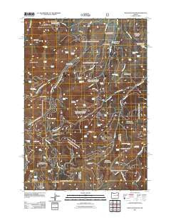
~ Rastus Mountain OR topo map, 1:24000 scale, 7.5 X 7.5 Minute, Historical, 2011
Rastus Mountain, Oregon, USGS topographic map dated 2011.
Includes geographic coordinates (latitude and longitude). This topographic map is suitable for hiking, camping, and exploring, or framing it as a wall map.
Printed on-demand using high resolution imagery, on heavy weight and acid free paper, or alternatively on a variety of synthetic materials.
Topos available on paper, Waterproof, Poly, or Tyvek. Usually shipping rolled, unless combined with other folded maps in one order.
- Product Number: USGS-5310942
- Free digital map download (high-resolution, GeoPDF): Rastus Mountain, Oregon (file size: 23 MB)
- Map Size: please refer to the dimensions of the GeoPDF map above
- Weight (paper map): ca. 55 grams
- Map Type: POD USGS Topographic Map
- Map Series: US Topo
- Map Verison: Historical
- Cell ID: 37083
- Datum: North American Datum of 1983
- Map Projection: Transverse Mercator
- Map Cell Name: Rastus Mountain
- Grid size: 7.5 X 7.5 Minute
- Date on map: 2011
- Map Scale: 1:24000
- Geographical region: Oregon, United States
Neighboring Maps:
All neighboring USGS topo maps are available for sale online at a variety of scales.
Spatial coverage:
Topo map Rastus Mountain, Oregon, covers the geographical area associated the following places:
- Waqíima Butte - Jerry Spring - Cold Spring - Hole in the Ground Spring - Long Creek Reservoir - Dave Spring - Long Creek Recreation Site - Hamms Spring - Rough Ridge - Luther Butte - Bastard Spring - Cabin Spring - Broken Top Spring - Grouse Spring - Malheur Spring - Ledge Spring - Prospect Spring - Waqíima Spring - Jackass Spring - Johnson Gulch Spring - Skull Gulch Spring - Waterfall Creek - Koski Basin - Road Spring - Saddle Spring - Tammy Pond - Pasture Spring - Lost Cow Spring - Wonder Spring - Johnson Ditch Spring - Murray Hill - Feller Pond - Bullrun Mountain - Gravel Spring - Jackson Spring - Divide Pond - Schwayder Mine - Skull Spring - Long Creek Dam - Mule Spring - Elk Camp Spring - Skull Gulch - Rastus Creek - South Fork Camp Creek Campground - Payraise Spring - Block and Tackle Spring - Sheephead Mountain - Cowboy Spring - Bathtub Spring - King Creek - North Fork West Camp Creek - Rastus Camp Spring - Murray Hill Spring - Hondu Spring - Norna Spring - Whiskey Creek - Crystal Spring - Rastus Mountain - Thomason Mine - Lizard Spring - South Fork West Camp Creek - Sheephead Mountain Spring - Surprise Spring
- Map Area ID: AREA44.37544.25-118.25-118.125
- Northwest corner Lat/Long code: USGSNW44.375-118.25
- Northeast corner Lat/Long code: USGSNE44.375-118.125
- Southwest corner Lat/Long code: USGSSW44.25-118.25
- Southeast corner Lat/Long code: USGSSE44.25-118.125
- Northern map edge Latitude: 44.375
- Southern map edge Latitude: 44.25
- Western map edge Longitude: -118.25
- Eastern map edge Longitude: -118.125


