
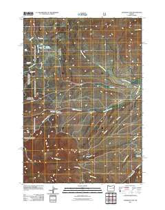
~ Eldorado Pass OR topo map, 1:24000 scale, 7.5 X 7.5 Minute, Historical, 2011
Eldorado Pass, Oregon, USGS topographic map dated 2011.
Includes geographic coordinates (latitude and longitude). This topographic map is suitable for hiking, camping, and exploring, or framing it as a wall map.
Printed on-demand using high resolution imagery, on heavy weight and acid free paper, or alternatively on a variety of synthetic materials.
Topos available on paper, Waterproof, Poly, or Tyvek. Usually shipping rolled, unless combined with other folded maps in one order.
- Product Number: USGS-5310918
- Free digital map download (high-resolution, GeoPDF): Eldorado Pass, Oregon (file size: 18 MB)
- Map Size: please refer to the dimensions of the GeoPDF map above
- Weight (paper map): ca. 55 grams
- Map Type: POD USGS Topographic Map
- Map Series: US Topo
- Map Verison: Historical
- Cell ID: 13877
- Datum: North American Datum of 1983
- Map Projection: Transverse Mercator
- Map Cell Name: Eldorado Pass
- Grid size: 7.5 X 7.5 Minute
- Date on map: 2011
- Map Scale: 1:24000
- Geographical region: Oregon, United States
Neighboring Maps:
All neighboring USGS topo maps are available for sale online at a variety of scales.
Spatial coverage:
Topo map Eldorado Pass, Oregon, covers the geographical area associated the following places:
- Lake Gulch - Dickson Reservoir - Black Stump Gulch - Murray Dam - Unity Forest State Park - Tyler Draw - Dickson Dam - Eldorado Pass - Ditch Spring - Cottonwood Creek - High Horn Reservoir - Ironside C and H Corrals - Milk Creek - North Willow Creek - HB Murray - Between Pond - Murray Reservoir - Eldorado Recreation Site - Little Black Stump Gulch - Murray Reservoir Recreation Site - Beam Creek
- Map Area ID: AREA44.37544.25-118.125-118
- Northwest corner Lat/Long code: USGSNW44.375-118.125
- Northeast corner Lat/Long code: USGSNE44.375-118
- Southwest corner Lat/Long code: USGSSW44.25-118.125
- Southeast corner Lat/Long code: USGSSE44.25-118
- Northern map edge Latitude: 44.375
- Southern map edge Latitude: 44.25
- Western map edge Longitude: -118.125
- Eastern map edge Longitude: -118


