
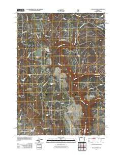
~ Dollar Basin OR topo map, 1:24000 scale, 7.5 X 7.5 Minute, Historical, 2011
Dollar Basin, Oregon, USGS topographic map dated 2011.
Includes geographic coordinates (latitude and longitude). This topographic map is suitable for hiking, camping, and exploring, or framing it as a wall map.
Printed on-demand using high resolution imagery, on heavy weight and acid free paper, or alternatively on a variety of synthetic materials.
Topos available on paper, Waterproof, Poly, or Tyvek. Usually shipping rolled, unless combined with other folded maps in one order.
- Product Number: USGS-5310916
- Free digital map download (high-resolution, GeoPDF): Dollar Basin, Oregon (file size: 26 MB)
- Map Size: please refer to the dimensions of the GeoPDF map above
- Weight (paper map): ca. 55 grams
- Map Type: POD USGS Topographic Map
- Map Series: US Topo
- Map Verison: Historical
- Cell ID: 12481
- Datum: North American Datum of 1983
- Map Projection: Transverse Mercator
- Map Cell Name: Dollar Basin
- Grid size: 7.5 X 7.5 Minute
- Date on map: 2011
- Map Scale: 1:24000
- Geographical region: Oregon, United States
Neighboring Maps:
All neighboring USGS topo maps are available for sale online at a variety of scales.
Spatial coverage:
Topo map Dollar Basin, Oregon, covers the geographical area associated the following places:
- Miller Flat Spring - Dollar Basin - Altnow Spring - Dry Meadow - Box Spring - Sheep Corral Spring - Miller Flat Creek - Cold Spring Canyon - Malheur Ford Camp (historical) - Black Canyon Creek - Malheur Ford - Skookum Spring - McAllister Spring - Lee Creek - Miller Flat - Blinn Spring - Tamarack Camp (historical) - Hawk Spring (historical) - Tamarack Spring - Lake Camp Gulch - McArthur Spring - Diamond Dot Gulch - Skookum Canyon - Hog Flat Spring - Rock Spring - Wade Spring - Summit Creek - Little Bear Spring - Cliff Creek - Twin Spring - Malheur River Trailhead - Mike Acton Spring - Rock Spring - Skookum Creek - Yellowjacket Spring - Jordan Spring - Cold Spring - Dollar Basin Creek - Black Canyon - Lake Camp Spring - Tureman Creek - Hog Flat
- Map Area ID: AREA44.12544-118.625-118.5
- Northwest corner Lat/Long code: USGSNW44.125-118.625
- Northeast corner Lat/Long code: USGSNE44.125-118.5
- Southwest corner Lat/Long code: USGSSW44-118.625
- Southeast corner Lat/Long code: USGSSE44-118.5
- Northern map edge Latitude: 44.125
- Southern map edge Latitude: 44
- Western map edge Longitude: -118.625
- Eastern map edge Longitude: -118.5


