
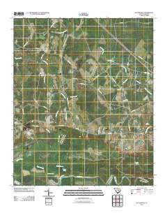
~ Butlers Bay SC topo map, 1:24000 scale, 7.5 X 7.5 Minute, Historical, 2011
Butlers Bay, South Carolina, USGS topographic map dated 2011.
Includes geographic coordinates (latitude and longitude). This topographic map is suitable for hiking, camping, and exploring, or framing it as a wall map.
Printed on-demand using high resolution imagery, on heavy weight and acid free paper, or alternatively on a variety of synthetic materials.
Topos available on paper, Waterproof, Poly, or Tyvek. Usually shipping rolled, unless combined with other folded maps in one order.
- Product Number: USGS-5310774
- Free digital map download (high-resolution, GeoPDF): Butlers Bay, South Carolina (file size: 24 MB)
- Map Size: please refer to the dimensions of the GeoPDF map above
- Weight (paper map): ca. 55 grams
- Map Type: POD USGS Topographic Map
- Map Series: US Topo
- Map Verison: Historical
- Cell ID: 6475
- Datum: North American Datum of 1983
- Map Projection: Transverse Mercator
- Map Cell Name: Butlers Bay
- Grid size: 7.5 X 7.5 Minute
- Date on map: 2011
- Map Scale: 1:24000
- Geographical region: South Carolina, United States
Neighboring Maps:
All neighboring USGS topo maps are available for sale online at a variety of scales.
Spatial coverage:
Topo map Butlers Bay, South Carolina, covers the geographical area associated the following places:
- Tarkiln Branch - Riggs Pond Dam D-3507 - Santee Rosenwald School (historical) - Butlers Bay - Long Branch Church - Long Branch - Sandhill Bay - Islanded Bay - Riggs Pond - Hunter School (historical) - Pine Grove Church - Mill Branch - Mount Hope Swamp - Oak Grove Church (historical) - Buck Bay - Franks Lake - Doctor Branch - Saint Lukes Church - Saint Johns School (historical) - Broad Lake - Keels Cemetery - Hog Meadow Swamp - Green Hill Church - Doctor Hole - Little Lake - Torkiln Branch - Hunter School (historical) - Doctor Hole - Highland Creek - Tiger Bay - Little Solomon Lake
- Map Area ID: AREA33.62533.5-80.125-80
- Northwest corner Lat/Long code: USGSNW33.625-80.125
- Northeast corner Lat/Long code: USGSNE33.625-80
- Southwest corner Lat/Long code: USGSSW33.5-80.125
- Southeast corner Lat/Long code: USGSSE33.5-80
- Northern map edge Latitude: 33.625
- Southern map edge Latitude: 33.5
- Western map edge Longitude: -80.125
- Eastern map edge Longitude: -80


