
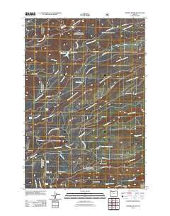
~ Fivemile Butte OR topo map, 1:24000 scale, 7.5 X 7.5 Minute, Historical, 2011
Fivemile Butte, Oregon, USGS topographic map dated 2011.
Includes geographic coordinates (latitude and longitude). This topographic map is suitable for hiking, camping, and exploring, or framing it as a wall map.
Printed on-demand using high resolution imagery, on heavy weight and acid free paper, or alternatively on a variety of synthetic materials.
Topos available on paper, Waterproof, Poly, or Tyvek. Usually shipping rolled, unless combined with other folded maps in one order.
- Product Number: USGS-5310604
- Free digital map download (high-resolution, GeoPDF): Fivemile Butte, Oregon (file size: 23 MB)
- Map Size: please refer to the dimensions of the GeoPDF map above
- Weight (paper map): ca. 55 grams
- Map Type: POD USGS Topographic Map
- Map Series: US Topo
- Map Verison: Historical
- Cell ID: 76485
- Datum: North American Datum of 1983
- Map Projection: Transverse Mercator
- Map Cell Name: Fivemile Butte
- Grid size: 7.5 X 7.5 Minute
- Date on map: 2011
- Map Scale: 1:24000
- Geographical region: Oregon, United States
Neighboring Maps:
All neighboring USGS topo maps are available for sale online at a variety of scales.
Spatial coverage:
Topo map Fivemile Butte, Oregon, covers the geographical area associated the following places:
- Camp Baldwin Lake - Underhill Recreation Site - Wampus Springs - Birdseye Spring - Johns Mill Trail - Joes Point - Pebble Ford Recreation Site - Knebal Spring Recreation Site - Knebal Spring - Crow Creek Reservoir - Fifteenmile Creek Trail - Pollywog Spring - Fivemile Butte - Crow Creek - Camp Baldwin - Bottle Prairie Trail - Skyline Quarry - Perry Point - Saddle Spring - Bascom Spring - Deadman Gulch - Puma Spring - Joe's Point Quarry - Cedar Creek - Hillary Grade - Lower Eightmile Crossing Recreation Site - Eightmile Crossing Recreation Site - Jacket Springs - Crow Creek Dam - Alder Creek - Glade Spring - Station Spring - Stroud Springs
- Map Area ID: AREA45.545.375-121.5-121.375
- Northwest corner Lat/Long code: USGSNW45.5-121.5
- Northeast corner Lat/Long code: USGSNE45.5-121.375
- Southwest corner Lat/Long code: USGSSW45.375-121.5
- Southeast corner Lat/Long code: USGSSE45.375-121.375
- Northern map edge Latitude: 45.5
- Southern map edge Latitude: 45.375
- Western map edge Longitude: -121.5
- Eastern map edge Longitude: -121.375


