
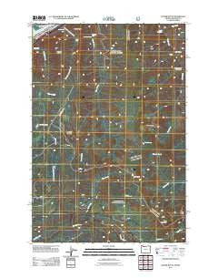
~ Tanner Butte OR topo map, 1:24000 scale, 7.5 X 7.5 Minute, Historical, 2011
Tanner Butte, Oregon, USGS topographic map dated 2011.
Includes geographic coordinates (latitude and longitude). This topographic map is suitable for hiking, camping, and exploring, or framing it as a wall map.
Printed on-demand using high resolution imagery, on heavy weight and acid free paper, or alternatively on a variety of synthetic materials.
Topos available on paper, Waterproof, Poly, or Tyvek. Usually shipping rolled, unless combined with other folded maps in one order.
- Product Number: USGS-5310584
- Free digital map download (high-resolution, GeoPDF): Tanner Butte, Oregon (file size: 25 MB)
- Map Size: please refer to the dimensions of the GeoPDF map above
- Weight (paper map): ca. 55 grams
- Map Type: POD USGS Topographic Map
- Map Series: US Topo
- Map Verison: Historical
- Cell ID: 44283
- Datum: North American Datum of 1983
- Map Projection: Transverse Mercator
- Map Cell Name: Tanner Butte
- Grid size: 7.5 X 7.5 Minute
- Date on map: 2011
- Map Scale: 1:24000
- Geographical region: Oregon, United States
Neighboring Maps:
All neighboring USGS topo maps are available for sale online at a variety of scales.
Spatial coverage:
Topo map Tanner Butte, Oregon, covers the geographical area associated the following places:
- Wahclella Falls - Wauneka Point - Moffett Falls - Punch Bowl Falls - Eagle Tanner Trail - Loowit Falls - Moffett Creek - Dublin Lake - Four One Half Mile Bridge - Tanner Butte Trail - Elowah Falls - Palmer Lake - Tish Creek - Metasequoia Creek - Eagle Butte - Wahe Falls - Munra Point - Falls Creek - Tanner Spring - Tanner Cutoff Trail - Nesmith Point Trail - Big Cedar Springs - Hamilton Island Reach - Log Creek - Ives Island - Table Mountain - Stone (historical) - Warrendale Upper Range - Tanner Butte - Mount Talapus - West Branch Falls Creek - Thrush Pond - Tenas Camp (historical) - John B Yeon State Park - High Bridge - Tanner Creek Falls
- Map Area ID: AREA45.62545.5-122-121.875
- Northwest corner Lat/Long code: USGSNW45.625-122
- Northeast corner Lat/Long code: USGSNE45.625-121.875
- Southwest corner Lat/Long code: USGSSW45.5-122
- Southeast corner Lat/Long code: USGSSE45.5-121.875
- Northern map edge Latitude: 45.625
- Southern map edge Latitude: 45.5
- Western map edge Longitude: -122
- Eastern map edge Longitude: -121.875


