
~ Flag Point OR topo map, 1:24000 scale, 7.5 X 7.5 Minute, Historical, 2011
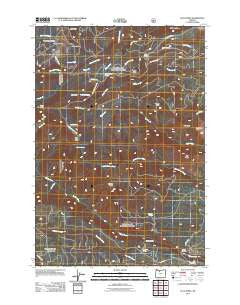
Flag Point, Oregon, USGS topographic map dated 2011.
Includes geographic coordinates (latitude and longitude). This topographic map is suitable for hiking, camping, and exploring, or framing it as a wall map.
Printed on-demand using high resolution imagery, on heavy weight and acid free paper, or alternatively on a variety of synthetic materials.
Topos available on paper, Waterproof, Poly, or Tyvek. Usually shipping rolled, unless combined with other folded maps in one order.
- Product Number: USGS-5310550
- Free digital map download (high-resolution, GeoPDF): Flag Point, Oregon (file size: 26 MB)
- Map Size: please refer to the dimensions of the GeoPDF map above
- Weight (paper map): ca. 55 grams
- Map Type: POD USGS Topographic Map
- Map Series: US Topo
- Map Verison: Historical
- Cell ID: 15435
- Datum: North American Datum of 1983
- Map Projection: Transverse Mercator
- Map Cell Name: Flag Point
- Grid size: 7.5 X 7.5 Minute
- Date on map: 2011
- Map Scale: 1:24000
- Geographical region: Oregon, United States
Neighboring Maps:
All neighboring USGS topo maps are available for sale online at a variety of scales.
Spatial coverage:
Topo map Flag Point, Oregon, covers the geographical area associated the following places:
- Flag Point - Sunrise Springs - Jordan Cutoff Trail - Pen Point - Camp Friend - Little Badger Creek Trail - Frailey Point - Marion Point - Sunset Spring - Pine Creek - Oval Lake - Threemile Trail - Ball Point Trail - Eightmile Point - Jordan Butte - Bird Spring - Tygh Creek Trail - Fret Creek - Denest Spring - Badger Creek Trail - Owl Quarry - Marion Creek - Pen Way Trail - Bennett Spring - Hootnanny Point - Bonney Crossing Recreation Site - Bulo Point - Goat Creek - Fifteen Mile Recreation Site - Cold Point - Bonney Crossing - Cold Spring - Eightmile Meadow - Ball Point - Three Bear Spring - Frailey Point Trail - Drop Creek - Shadley Spring - Cedar Creek Spring - Springer Ditch - Gordon Butte Trail - Springer Ridge - Badger Creek Wilderness - Gordon Butte - Steeds Crossing - Stockton Spring
- Map Area ID: AREA45.37545.25-121.5-121.375
- Northwest corner Lat/Long code: USGSNW45.375-121.5
- Northeast corner Lat/Long code: USGSNE45.375-121.375
- Southwest corner Lat/Long code: USGSSW45.25-121.5
- Southeast corner Lat/Long code: USGSSE45.25-121.375
- Northern map edge Latitude: 45.375
- Southern map edge Latitude: 45.25
- Western map edge Longitude: -121.5
- Eastern map edge Longitude: -121.375


