
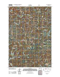
~ Dolph OR topo map, 1:24000 scale, 7.5 X 7.5 Minute, Historical, 2011
Dolph, Oregon, USGS topographic map dated 2011.
Includes geographic coordinates (latitude and longitude). This topographic map is suitable for hiking, camping, and exploring, or framing it as a wall map.
Printed on-demand using high resolution imagery, on heavy weight and acid free paper, or alternatively on a variety of synthetic materials.
Topos available on paper, Waterproof, Poly, or Tyvek. Usually shipping rolled, unless combined with other folded maps in one order.
- Product Number: USGS-5310414
- Free digital map download (high-resolution, GeoPDF): Dolph, Oregon (file size: 27 MB)
- Map Size: please refer to the dimensions of the GeoPDF map above
- Weight (paper map): ca. 55 grams
- Map Type: POD USGS Topographic Map
- Map Series: US Topo
- Map Verison: Historical
- Cell ID: 12495
- Datum: North American Datum of 1983
- Map Projection: Transverse Mercator
- Map Cell Name: Dolph
- Grid size: 7.5 X 7.5 Minute
- Date on map: 2011
- Map Scale: 1:24000
- Geographical region: Oregon, United States
Neighboring Maps:
All neighboring USGS topo maps are available for sale online at a variety of scales.
Spatial coverage:
Topo map Dolph, Oregon, covers the geographical area associated the following places:
- McAllister Creek - Bear Creek - Indian Creek - Widow Creek - Deer Creek - Trout Creek - Dolph - Conklin Creek - Baxter Creek - Little Creek - Swampy Creek - Muscott Creek - Muscott Bridge - Fall Creek - Neskowin Ridge - Alder Brook - Sulphur Creek - Kautz Creek - Salmon River Guard Station - Little Salmon River - Stillwell Creek - Treat River - Salmon River State Forest Service Station - Sourgrass Creek - Judson Creek - Gunaldo Falls - West Fork Salmon River - South Fork Little Nestucca River - Dolph Post Office (historical) - H B Van Duzer Forest State Scenic Corridor - Prairie Creek - Bear Creek - Little Nestucca Camp (historical) - Yach Bridge - Hiack Creek - Louie Creek - Pitner Post Office (historical) - Boulder Creek - Boyer Post Office (historical) - Small Creek - Cedar Creek - McKnight Creek - Weed Bridge
- Map Area ID: AREA45.12545-123.875-123.75
- Northwest corner Lat/Long code: USGSNW45.125-123.875
- Northeast corner Lat/Long code: USGSNE45.125-123.75
- Southwest corner Lat/Long code: USGSSW45-123.875
- Southeast corner Lat/Long code: USGSSE45-123.75
- Northern map edge Latitude: 45.125
- Southern map edge Latitude: 45
- Western map edge Longitude: -123.875
- Eastern map edge Longitude: -123.75


