
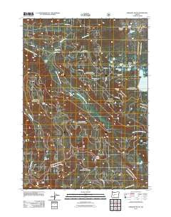
~ Emigrant Butte OR topo map, 1:24000 scale, 7.5 X 7.5 Minute, Historical, 2011
Emigrant Butte, Oregon, USGS topographic map dated 2011.
Includes geographic coordinates (latitude and longitude). This topographic map is suitable for hiking, camping, and exploring, or framing it as a wall map.
Printed on-demand using high resolution imagery, on heavy weight and acid free paper, or alternatively on a variety of synthetic materials.
Topos available on paper, Waterproof, Poly, or Tyvek. Usually shipping rolled, unless combined with other folded maps in one order.
- Product Number: USGS-5310384
- Free digital map download (high-resolution, GeoPDF): Emigrant Butte, Oregon (file size: 29 MB)
- Map Size: please refer to the dimensions of the GeoPDF map above
- Weight (paper map): ca. 55 grams
- Map Type: POD USGS Topographic Map
- Map Series: US Topo
- Map Verison: Historical
- Cell ID: 14293
- Datum: North American Datum of 1983
- Map Projection: Transverse Mercator
- Map Cell Name: Emigrant Butte
- Grid size: 7.5 X 7.5 Minute
- Date on map: 2011
- Map Scale: 1:24000
- Geographical region: Oregon, United States
Neighboring Maps:
All neighboring USGS topo maps are available for sale online at a variety of scales.
Spatial coverage:
Topo map Emigrant Butte, Oregon, covers the geographical area associated the following places:
- Alpine Lake - Mosquito Lake - Emigrant Forest Camp - Happy Prairie Way - Marie Lake - Swamp Way - Summit Lake Boat Launch - Hemlock Lake - Spruce Lake - Paddys Valley - Pioneer Way - Ruth Lake - Fir Lake - Emigrant Butte - Sunset Lake - Warm Spring Butte - Happy Prairie - Alameda Lake - June Lake - Beaver Creek - Sunrise Lake - Sawtooth Way - Hills Peak - Reflection Lake - Big Swamp - Emigrant Pass - Emigrant Creek - Bug Lake - Birds Point - Rockpile Lake - Neet Lake - Beaver Marsh - McGowan Mountain Way - Summit Lake Recreation Site - Diamond Rockpile - Timpanogas Way
- Map Area ID: AREA43.543.375-122.25-122.125
- Northwest corner Lat/Long code: USGSNW43.5-122.25
- Northeast corner Lat/Long code: USGSNE43.5-122.125
- Southwest corner Lat/Long code: USGSSW43.375-122.25
- Southeast corner Lat/Long code: USGSSE43.375-122.125
- Northern map edge Latitude: 43.5
- Southern map edge Latitude: 43.375
- Western map edge Longitude: -122.25
- Eastern map edge Longitude: -122.125


