
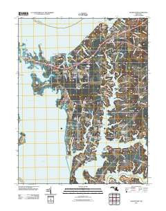
~ Queenstown MD topo map, 1:24000 scale, 7.5 X 7.5 Minute, Historical, 2011
Queenstown, Maryland, USGS topographic map dated 2011.
Includes geographic coordinates (latitude and longitude). This topographic map is suitable for hiking, camping, and exploring, or framing it as a wall map.
Printed on-demand using high resolution imagery, on heavy weight and acid free paper, or alternatively on a variety of synthetic materials.
Topos available on paper, Waterproof, Poly, or Tyvek. Usually shipping rolled, unless combined with other folded maps in one order.
- Product Number: USGS-5310200
- Free digital map download (high-resolution, GeoPDF): Queenstown, Maryland (file size: 16 MB)
- Map Size: please refer to the dimensions of the GeoPDF map above
- Weight (paper map): ca. 55 grams
- Map Type: POD USGS Topographic Map
- Map Series: US Topo
- Map Verison: Historical
- Cell ID: 36781
- Datum: North American Datum of 1983
- Map Projection: Transverse Mercator
- Map Cell Name: Queenstown
- Grid size: 7.5 X 7.5 Minute
- Date on map: 2011
- Map Scale: 1:24000
- Geographical region: Maryland, United States
Neighboring Maps:
All neighboring USGS topo maps are available for sale online at a variety of scales.
Spatial coverage:
Topo map Queenstown, Maryland, covers the geographical area associated the following places:
- Governor Grayson Manor - Sayers Forest - Country Acres - Bennetts Point - Queen Anne Woods - River Bend Estates - Windward Cove - Woodbury Acres - Fisher Manor - Wye River Farms - Wye Harbor - Belle Point Farm - East Prospect Plantation - Chester River Beach - Wye Acres - Carmichael - Cheston on the Wye - Bryantown - Mainbrace - Prospect Bay - Winchester Estates - Guys - Queen Annes on Wye - Grasonville - Queen Annes Estates - Overlook - Watersman - Queen Annes Acres - Queenstown - Blair Woods - Beach Harbor Mobile Home Park - Sportsman Hall - Hickory Ridge - Perrys Corner - Kent Narrows - White House Acres - Narrows
- Map Area ID: AREA3938.875-76.25-76.125
- Northwest corner Lat/Long code: USGSNW39-76.25
- Northeast corner Lat/Long code: USGSNE39-76.125
- Southwest corner Lat/Long code: USGSSW38.875-76.25
- Southeast corner Lat/Long code: USGSSE38.875-76.125
- Northern map edge Latitude: 39
- Southern map edge Latitude: 38.875
- Western map edge Longitude: -76.25
- Eastern map edge Longitude: -76.125


