
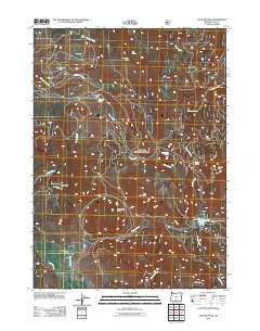
~ Cougar Peak OR topo map, 1:24000 scale, 7.5 X 7.5 Minute, Historical, 2011
Cougar Peak, Oregon, USGS topographic map dated 2011.
Includes geographic coordinates (latitude and longitude). This topographic map is suitable for hiking, camping, and exploring, or framing it as a wall map.
Printed on-demand using high resolution imagery, on heavy weight and acid free paper, or alternatively on a variety of synthetic materials.
Topos available on paper, Waterproof, Poly, or Tyvek. Usually shipping rolled, unless combined with other folded maps in one order.
- Product Number: USGS-5310066
- Free digital map download (high-resolution, GeoPDF): Cougar Peak, Oregon (file size: 28 MB)
- Map Size: please refer to the dimensions of the GeoPDF map above
- Weight (paper map): ca. 55 grams
- Map Type: POD USGS Topographic Map
- Map Series: US Topo
- Map Verison: Historical
- Cell ID: 10336
- Datum: North American Datum of 1983
- Map Projection: Transverse Mercator
- Map Cell Name: Cougar Peak
- Grid size: 7.5 X 7.5 Minute
- Date on map: 2011
- Map Scale: 1:24000
- Geographical region: Oregon, United States
Neighboring Maps:
All neighboring USGS topo maps are available for sale online at a variety of scales.
Spatial coverage:
Topo map Cougar Peak, Oregon, covers the geographical area associated the following places:
- Rosalite Mine - Dutch Oven Flat - McClendon Spring - Drews Valley Ranch - Grizzly Creek - Cottonwood Meadow Dam - Coleman Rim - Pot Flat - Big Spring - Blue Mountain - Cottonwood Meadow Recreation Area Boat Ramp - Beaver Dam Picnic Ground (historical) - Hidden Springs - Grizzly Peak - Angel Peak - Shoesole Flat - Cougar Creek - Angel Peak Mine - Razor Back Ridge - Old Stage Station (historical) - Hilario Spring - Cottonwood Recreation Site - Cottonwood Meadow Lake - Cottonwood Complex Campground - Mammoth Spring - Shoesole Spring - Lucky Camp - Cougar Peak - Cottonwood Meadow Campground Boat Ramp - Howard Creek
- Map Area ID: AREA42.37542.25-120.75-120.625
- Northwest corner Lat/Long code: USGSNW42.375-120.75
- Northeast corner Lat/Long code: USGSNE42.375-120.625
- Southwest corner Lat/Long code: USGSSW42.25-120.75
- Southeast corner Lat/Long code: USGSSE42.25-120.625
- Northern map edge Latitude: 42.375
- Southern map edge Latitude: 42.25
- Western map edge Longitude: -120.75
- Eastern map edge Longitude: -120.625


