
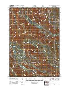
~ Mount David Douglas OR topo map, 1:24000 scale, 7.5 X 7.5 Minute, Historical, 2011
Mount David Douglas, Oregon, USGS topographic map dated 2011.
Includes geographic coordinates (latitude and longitude). This topographic map is suitable for hiking, camping, and exploring, or framing it as a wall map.
Printed on-demand using high resolution imagery, on heavy weight and acid free paper, or alternatively on a variety of synthetic materials.
Topos available on paper, Waterproof, Poly, or Tyvek. Usually shipping rolled, unless combined with other folded maps in one order.
- Product Number: USGS-5295635
- Free digital map download (high-resolution, GeoPDF): Mount David Douglas, Oregon (file size: 27 MB)
- Map Size: please refer to the dimensions of the GeoPDF map above
- Weight (paper map): ca. 55 grams
- Map Type: POD USGS Topographic Map
- Map Series: US Topo
- Map Verison: Historical
- Cell ID: 30554
- Datum: North American Datum of 1983
- Map Projection: Transverse Mercator
- Map Cell Name: Mount David Douglas
- Grid size: 7.5 X 7.5 Minute
- Date on map: 2011
- Map Scale: 1:24000
- Geographical region: Oregon, United States
Neighboring Maps:
All neighboring USGS topo maps are available for sale online at a variety of scales.
Spatial coverage:
Topo map Mount David Douglas, Oregon, covers the geographical area associated the following places:
- Eagle Camp - Petite Creek - Bunchgrass Ridge - Koch Mountain Trail - Twin Creek - Spirit Lake - South Fork Salt Creek - Shady Creek - Salt Creek Safety Rest Area (historical) - Cornpatch Prairie - Noisy Creek - Swamp Creek - Cruzatte Post Office (historical) - Rhododendron Island - Cruzatte - Mount David Douglas - Coyote Creek - Hells Hall Acre - Cedar Creek - Last Creek - Beamer Ranch - Verdun Rock - Heather - Verdun Way - Helen Creek Way - Cupit Mary Trail - Eagle Creek - Fuji Meadow - Cascade Creek - Doe Creek - Lucas Lake - Big Bunchgrass - Louise Creek
- Map Area ID: AREA43.7543.625-122.25-122.125
- Northwest corner Lat/Long code: USGSNW43.75-122.25
- Northeast corner Lat/Long code: USGSNE43.75-122.125
- Southwest corner Lat/Long code: USGSSW43.625-122.25
- Southeast corner Lat/Long code: USGSSE43.625-122.125
- Northern map edge Latitude: 43.75
- Southern map edge Latitude: 43.625
- Western map edge Longitude: -122.25
- Eastern map edge Longitude: -122.125


