
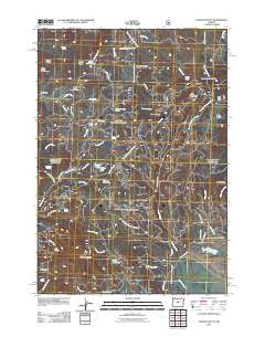
~ Ochoco Butte OR topo map, 1:24000 scale, 7.5 X 7.5 Minute, Historical, 2011
Ochoco Butte, Oregon, USGS topographic map dated 2011.
Includes geographic coordinates (latitude and longitude). This topographic map is suitable for hiking, camping, and exploring, or framing it as a wall map.
Printed on-demand using high resolution imagery, on heavy weight and acid free paper, or alternatively on a variety of synthetic materials.
Topos available on paper, Waterproof, Poly, or Tyvek. Usually shipping rolled, unless combined with other folded maps in one order.
- Product Number: USGS-5295150
- Free digital map download (high-resolution, GeoPDF): Ochoco Butte, Oregon (file size: 26 MB)
- Map Size: please refer to the dimensions of the GeoPDF map above
- Weight (paper map): ca. 55 grams
- Map Type: POD USGS Topographic Map
- Map Series: US Topo
- Map Verison: Historical
- Cell ID: 32877
- Datum: North American Datum of 1983
- Map Projection: Transverse Mercator
- Map Cell Name: Ochoco Butte
- Grid size: 7.5 X 7.5 Minute
- Date on map: 2011
- Map Scale: 1:24000
- Geographical region: Oregon, United States
Neighboring Maps:
All neighboring USGS topo maps are available for sale online at a variety of scales.
Spatial coverage:
Topo map Ochoco Butte, Oregon, covers the geographical area associated the following places:
- Scissorsville - Howard Spring - Thronson Creek - Sheep Corrals - Davis Spring - Cady Creek - Carroll Butte - East Fork Howard Creek - Indian Butte - Bacon Reservoir - Wildhorse Spring - Indian Prairie - Thompson Spring - Slide Lake - Lava Spring - Camp Creek - Mayflower Mining Settlement (historical) - Carroll Glade Springs - Simpson Place - Lunch Spring - Cole Spring - Ochoco Mine - Round Mountain - Lost Lake Spring - Prospect Spring - Walton Lake Boat Ramp - Mud Spring - Merritt Creek - Ahalt Creek - Cram Reservoir - Fisher Spring - Hellbore Spring - McAllister Creek - Ochoco Post Office (historical) - Ochoco Spring - Judy Spring - Arthur Creek Camp - Trail Spring - Lake Spring - McAllister Spring - Walton Lake Recreation Site - Scissors Spring - Crystal Springs Organization Camp - Cup Spring - Butterfield Spring - Carroll Glade - Ochoco Butte - Round Mountain Mine - West Fork Howard Creek - Big Spread Spring - Lone Reservoir - King Dam - Wildwood Recreation Site - Old Kelly Mill (historical) - Dunn Spring - Corral Flat - Slide Mountain - Walton Lake - Walton Lake Campground - Poison Spring - South Fork Howard Creek
- Map Area ID: AREA44.544.375-120.375-120.25
- Northwest corner Lat/Long code: USGSNW44.5-120.375
- Northeast corner Lat/Long code: USGSNE44.5-120.25
- Southwest corner Lat/Long code: USGSSW44.375-120.375
- Southeast corner Lat/Long code: USGSSE44.375-120.25
- Northern map edge Latitude: 44.5
- Southern map edge Latitude: 44.375
- Western map edge Longitude: -120.375
- Eastern map edge Longitude: -120.25


