
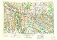
~ Paducah KY topo map, 1:250000 scale, 1 X 2 Degree, Historical, 1949, updated 1971
Paducah, Kentucky, USGS topographic map dated 1949.
Includes geographic coordinates (latitude and longitude). This topographic map is suitable for hiking, camping, and exploring, or framing it as a wall map.
Printed on-demand using high resolution imagery, on heavy weight and acid free paper, or alternatively on a variety of synthetic materials.
Topos available on paper, Waterproof, Poly, or Tyvek. Usually shipping rolled, unless combined with other folded maps in one order.
- Product Number: USGS-5295020
- Free digital map download (high-resolution, GeoPDF): Paducah, Kentucky (file size: 13 MB)
- Map Size: please refer to the dimensions of the GeoPDF map above
- Weight (paper map): ca. 55 grams
- Map Type: POD USGS Topographic Map
- Map Series: HTMC
- Map Verison: Historical
- Cell ID: 68951
- Scan ID: 707507
- Imprint Year: 1971
- Woodland Tint: Yes
- Aerial Photo Year: 1942
- Edit Year: 1969
- Datum: Unstated
- Map Projection: Transverse Mercator
- Map published by: Military, Other
- Map Language: English
- Scanner Resolution: 508 dpi
- Map Cell Name: Paducah
- Grid size: 1 X 2 Degree
- Date on map: 1949
- Map Scale: 1:250000
- Geographical region: Kentucky, United States
Neighboring Maps:
All neighboring USGS topo maps are available for sale online at a variety of scales.
Spatial coverage:
Topo map Paducah, Kentucky, covers the geographical area associated the following places:
- West Vienna - Pinckneyville - West Future City - Paducah - Pershing - Wittenberg - Metropolis - Makanda - Pulaski - Dongola - Neelys Landing - Carrier Mills - Stroderville (historical) - Lusk - Mount Pleasant - Dongola - Crosstown - Cape Girardeau - Harrison - West End - Mitchell - Schlatitz - Joy - Freeman Spur - Willisville - Olga - Dutch Mills - Diamond Cross - Golconda - Blairsville - Old Kaskaskia - Cairo Junction - Herrin Junction - Royalton - Levias - Ridgway - Unionville - Kelso - West Point - Spillertown - Massac - Toga - Newcastle - Mitchell Landing - McBride - Hicks - Angle Creek - Mounds - Cache - Liberty - Allens Spring - Crayne - Lutesville - Egypt Mills - Cottage Grove - Owens School (historical) - Omar - Wolf Creek - Woodland Hills - Chamness (historical) - Seventysix - Lemen Landing - Harrisburg - Mount Olive (historical) - Palzo - The Hall - Hickory Ridge - Milan (historical) - Cairo - Dog Walk - Forest Hill - Allenville - Antioch (historical) - Sand Ridge - Indian Hills - America - Little Cypress - Ardeola - Rum Branch - Crain - Sleepy Hollow - Alliance - Brookport - West Paducah - Blooming Rose (historical) - Dissen - New Hamburg - Junction - Stiles Crossing - Kaolin - White Hill - Friedheim - Hickory Leaf Mobile Home Park - Langs (historical) - Buena Vista - Bender (historical) - Belgique - Oakdale - Stone (historical) - Mount Carbon
- Map Area ID: AREA3837-90-88
- Northwest corner Lat/Long code: USGSNW38-90
- Northeast corner Lat/Long code: USGSNE38-88
- Southwest corner Lat/Long code: USGSSW37-90
- Southeast corner Lat/Long code: USGSSE37-88
- Northern map edge Latitude: 38
- Southern map edge Latitude: 37
- Western map edge Longitude: -90
- Eastern map edge Longitude: -88


