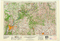
~ Louisville KY topo map, 1:250000 scale, 1 X 2 Degree, Historical, 1964, updated 1964
Louisville, Kentucky, USGS topographic map dated 1964.
Includes geographic coordinates (latitude and longitude). This topographic map is suitable for hiking, camping, and exploring, or framing it as a wall map.
Printed on-demand using high resolution imagery, on heavy weight and acid free paper, or alternatively on a variety of synthetic materials.
Topos available on paper, Waterproof, Poly, or Tyvek. Usually shipping rolled, unless combined with other folded maps in one order.
- Product Number: USGS-5295018
- Free digital map download (high-resolution, GeoPDF): Louisville, Kentucky (file size: 13 MB)
- Map Size: please refer to the dimensions of the GeoPDF map above
- Weight (paper map): ca. 55 grams
- Map Type: POD USGS Topographic Map
- Map Series: HTMC
- Map Verison: Historical
- Cell ID: 68883
- Scan ID: 803729
- Imprint Year: 1964
- Woodland Tint: Yes
- Field Check Year: 1956
- Datum: Unstated
- Map Projection: Transverse Mercator
- Map published by United States Geological Survey
- Map published by United States Army Corps of Engineers
- Map published by United States Army
- Map Language: English
- Scanner Resolution: 508 dpi
- Map Cell Name: Louisville
- Grid size: 1 X 2 Degree
- Date on map: 1964
- Map Scale: 1:250000
- Geographical region: Kentucky, United States
Neighboring Maps:
All neighboring USGS topo maps are available for sale online at a variety of scales.
Spatial coverage:
Topo map Louisville, Kentucky, covers the geographical area associated the following places:
- Merrifield - Petersburg - Poplar Thicket (historical) - Colville - Russell Cave - Plymouth Village - Pleasant Union (historical) - Lynnview - Seatonville - Hillview - Harmony Lake Estates - Norths Landing - Wrights Ridge (historical) - Persimmon Grove - Kenawood - Five Points - Hayes - Penile - Cross Plains - Carson - Henryville - Perry Park - Fox Chase - New Frankfort - Fincastle - Skinnersburg - Sycamore - Cardinal Hill - Dry Ridge (historical) - Peaks Mill - Wallace - Locust Ridge - Blackwell (historical) - Slatecut - Richwood - Druid Hills - Ten Broeck - Blackiston Village - Wirt - Demplytown - Four Oaks - Tucker Station - Delia - Bon Air Hills - New Castle - Bethel - Mockingbird Valley - Rosewood - Porter - Santa Fe - Eastland Park - Brighton - Prestonville - Carntown - Lamb - Hinton - Eminence - Moscow - Westwood - Gratz - Wellington - Glenmary - Gurley Corner - Leatherwoods Settlement (historical) - Graysville - Longview - New Albany - Adamsville (historical) - Mount Washington - Fourmile (historical) - Wildwood - Langoons - Scanland Springs Resort (historical) - Maryhill Estates - Downey Corner - Beechwood Village - Park Lake - Warrenton - White Sulphur - Spindletop Estates - Wilder Park - Bracktown - Windy Hills - Duval - Kiserton - Milton - Fisher Ridge (historical) - Hanover Beach - Jericho - Stony Point - Riverwood - Peak - New Columbus - Beaumont Park - Taylorsville - Indian Hills - Colony - Shadeland - Beckley - Austin
- Map Area ID: AREA3938-86-84
- Northwest corner Lat/Long code: USGSNW39-86
- Northeast corner Lat/Long code: USGSNE39-84
- Southwest corner Lat/Long code: USGSSW38-86
- Southeast corner Lat/Long code: USGSSE38-84
- Northern map edge Latitude: 39
- Southern map edge Latitude: 38
- Western map edge Longitude: -86
- Eastern map edge Longitude: -84

