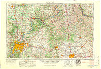
~ Louisville KY topo map, 1:250000 scale, 1 X 2 Degree, Historical, 1956, updated 1971
Louisville, Kentucky, USGS topographic map dated 1956.
Includes geographic coordinates (latitude and longitude). This topographic map is suitable for hiking, camping, and exploring, or framing it as a wall map.
Printed on-demand using high resolution imagery, on heavy weight and acid free paper, or alternatively on a variety of synthetic materials.
Topos available on paper, Waterproof, Poly, or Tyvek. Usually shipping rolled, unless combined with other folded maps in one order.
- Product Number: USGS-5295014
- Free digital map download (high-resolution, GeoPDF): Louisville, Kentucky (file size: 14 MB)
- Map Size: please refer to the dimensions of the GeoPDF map above
- Weight (paper map): ca. 55 grams
- Map Type: POD USGS Topographic Map
- Map Series: HTMC
- Map Verison: Historical
- Cell ID: 68883
- Scan ID: 707454
- Imprint Year: 1971
- Woodland Tint: Yes
- Aerial Photo Year: 1952
- Edit Year: 1969
- Field Check Year: 1956
- Datum: Unstated
- Map Projection: Transverse Mercator
- Map published by: Military, Other
- Map Language: English
- Scanner Resolution: 508 dpi
- Map Cell Name: Louisville
- Grid size: 1 X 2 Degree
- Date on map: 1956
- Map Scale: 1:250000
- Geographical region: Kentucky, United States
Neighboring Maps:
All neighboring USGS topo maps are available for sale online at a variety of scales.
Spatial coverage:
Topo map Louisville, Kentucky, covers the geographical area associated the following places:
- Floydsburg - Poplar Grove - Brooksville - Tarascon - Utica - Wilmington (historical) - Glenarm - Heatherfield - Tomtown (historical) - Seymour - Walnut Hill - Southern Heights - Blue River - Cranetown - Lake Louisvilla - Calloway Station (historical) - Medora - Rutland - Swanville - Worthington - South Boston - Radcliffe - Oneonta - Kingston - Callensville (historical) - Lamb - Madison - Nicholsville - Moorland - Breckinridge - Poplar Ridge (historical) - California - East Enterprise - Georgetown - Wallace - Colville - Cross Plains - Powersville - Polsgrove - Jimtown - Wilsonville - Birdie - Bennington - Salina - Mount Pleasant - Falmouth - Colletts (historical) - Plymouth Village - Arctic Springs - Victory Heights (historical) - Crestwood - Big Eddy - Peaks Mill - Cumminsville - Antioch - Olean - Sugar Grove - Buechel - Druid Hills - Saint Joseph - Clintonville - Newtown (historical) - Beechwood Village - Morgan - Fleming - Providence - Greenwood - Kentontown - Highview - Poindexter - Marshfield - Sunnyside (historical) - Browning Corner - Hollyvilla - New Frankfort - Glenview Acres - Seminary Village - Lindale - Hacienda - Little Kentucky (historical) - River Bluff - Fisher Ridge (historical) - Colony - Wellsburg - Cherokee Garden - Ryle - Florence - Bedford - Flag Fork - Merrifield - Concord - Oxford - Fairlane - Maple Valley (historical) - Portland - Cadentown - Kriete Corner - Wooster - Wayland Heights Addition (historical) - Hemp Ridge
- Map Area ID: AREA3938-86-84
- Northwest corner Lat/Long code: USGSNW39-86
- Northeast corner Lat/Long code: USGSNE39-84
- Southwest corner Lat/Long code: USGSSW38-86
- Southeast corner Lat/Long code: USGSSE38-84
- Northern map edge Latitude: 39
- Southern map edge Latitude: 38
- Western map edge Longitude: -86
- Eastern map edge Longitude: -84

