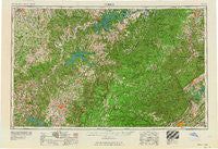
~ Corbin KY topo map, 1:250000 scale, 1 X 2 Degree, Historical, 1958
Corbin, Kentucky, USGS topographic map dated 1958.
Includes geographic coordinates (latitude and longitude). This topographic map is suitable for hiking, camping, and exploring, or framing it as a wall map.
Printed on-demand using high resolution imagery, on heavy weight and acid free paper, or alternatively on a variety of synthetic materials.
Topos available on paper, Waterproof, Poly, or Tyvek. Usually shipping rolled, unless combined with other folded maps in one order.
- Product Number: USGS-5295008
- Free digital map download (high-resolution, GeoPDF): Corbin, Kentucky (file size: 13 MB)
- Map Size: please refer to the dimensions of the GeoPDF map above
- Weight (paper map): ca. 55 grams
- Map Type: POD USGS Topographic Map
- Map Series: HTMC
- Map Verison: Historical
- Cell ID: 68730
- Scan ID: 803430
- Woodland Tint: Yes
- Field Check Year: 1956
- Datum: Unstated
- Map Projection: Transverse Mercator
- Map published by United States Geological Survey
- Map published by United States Army
- Map Language: English
- Scanner Resolution: 508 dpi
- Map Cell Name: Corbin
- Grid size: 1 X 2 Degree
- Date on map: 1958
- Map Scale: 1:250000
- Geographical region: Kentucky, United States
Neighboring Maps:
All neighboring USGS topo maps are available for sale online at a variety of scales.
Spatial coverage:
Topo map Corbin, Kentucky, covers the geographical area associated the following places:
- Anderson - Julip - Rockbridge - Arcott - Agee (historical) - Tanbark - Hermitage Springs - Nemo - Gibson Subdivision - Hickman - Russell Fork - Panther (historical) - Galen - Wilton - Rocky Point - Midway - Sumpter - Stockton - Huffman - Union - Hamptons Crossroads - Decide - Valley View Heights - Stowers - Midway - Cherrybrook - Abstons Corner - Tompkinsville - Sunbright - Indian Hills - Red Hill - Qualls (historical) - Rays - Faber - Isham - North Crossville Addition - Chestnut Mound - Saxton - Sycamore Valley - Murl - Remy - Suttons Mill (historical) - Winona - Blowing Springs - Burton - Griffin - Hillwood - Thompsons Store - Pacific (historical) - The Lowlands - Upchurch - Oak Grove - Clinch River (historical) - Cherry Hill - Elgin - Laurel Grove - Susie - Selby (historical) - Williams Creek (historical) - Long Meadows - Sulphur - Samaria - Faix - Creston - Ensor Park - Custer (historical) - Kino - Curtis - Ida - Browns - Emlyn - Oaklawn - Smyrna - Kilsyth - Helena - Bethesda - Ozone - Fairfield Glade - Winklers Crossroads - Temple Hill - Shea - Davidson - Nevisdale - Mill Springs - Terry Subdivision - Victory - Amandaville - Broad Acres - Clinch View - White Oak Junction - Gainesboro - Oakley - Holton - Number One - High Point - Modoc - Club Springs - Dal - Silerville - Gordonsville
- Map Area ID: AREA3736-86-84
- Northwest corner Lat/Long code: USGSNW37-86
- Northeast corner Lat/Long code: USGSNE37-84
- Southwest corner Lat/Long code: USGSSW36-86
- Southeast corner Lat/Long code: USGSSE36-84
- Northern map edge Latitude: 37
- Southern map edge Latitude: 36
- Western map edge Longitude: -86
- Eastern map edge Longitude: -84

