
~ Corbin KY topo map, 1:250000 scale, 1 X 2 Degree, Historical, 1956, updated 1981
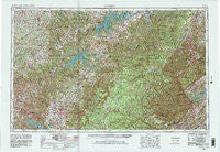
Corbin, Kentucky, USGS topographic map dated 1956.
Includes geographic coordinates (latitude and longitude). This topographic map is suitable for hiking, camping, and exploring, or framing it as a wall map.
Printed on-demand using high resolution imagery, on heavy weight and acid free paper, or alternatively on a variety of synthetic materials.
Topos available on paper, Waterproof, Poly, or Tyvek. Usually shipping rolled, unless combined with other folded maps in one order.
- Product Number: USGS-5295002
- Free digital map download (high-resolution, GeoPDF): Corbin, Kentucky (file size: 17 MB)
- Map Size: please refer to the dimensions of the GeoPDF map above
- Weight (paper map): ca. 55 grams
- Map Type: POD USGS Topographic Map
- Map Series: HTMC
- Map Verison: Historical
- Cell ID: 68730
- Scan ID: 803427
- Imprint Year: 1981
- Woodland Tint: Yes
- Photo Revision Year: 1965
- Edit Year: 1965
- Survey Year: 1956
- Datum: NAD27
- Map Projection: Transverse Mercator
- Map published by United States Army
- Map Language: English
- Scanner Resolution: 508 dpi
- Map Cell Name: Corbin
- Grid size: 1 X 2 Degree
- Date on map: 1956
- Map Scale: 1:250000
- Geographical region: Kentucky, United States
Neighboring Maps:
All neighboring USGS topo maps are available for sale online at a variety of scales.
Spatial coverage:
Topo map Corbin, Kentucky, covers the geographical area associated the following places:
- Five Springs - The Wye - Alpine - Etter - Green Pond - North Corbin - Cove Creek - Vox - Wynn - Stop (historical) - Blackburn Hills Estates - Casey Fork - Rinnie - Brotherton - Chestnut Mound - Piney - Hardy - Emory Valley - Stowers - Cumberland City - Maddux Farm - Genesis - Indian Creek - Murl - Lafayette - Meshack - Bowl (historical) - Woody - Foster Crossroads - Mount Union - Elmwood - Oak Dale - Ruppe (historical) - Whetstone (historical) - Tabor - Harlan Crossroads - Walnut Shade - Elgin - Isham - Yaden - Co-Operative - Lucky - Hail - Gar (historical) - Coal Hill - Baxter - Tackett Creek - Wartburg - Balltown - Campbell - Coalfield - Youngs Creek - Indian Hills - Jeffrey - Washington Heights - Shanky Branch - Free Hill - Upchurch - Red Ash - Buckeye - Cordell - Ashcroft Subdivision - New Haven - Rhyan Springs - Pleasant Ridge - Rosedale - Pacific (historical) - Bill Smith Subdivision - Boiling (historical) - Shiloh - Red Boiling Springs - Quinton - Hembree - Bakers Crossroads - Robbins - Bird (historical) - Chanute - Willow Grove - Beech Grove - Goad - Chaska - Maggarte (historical) - Nevelsville - Star Point - Leslie - Sand Springs - Charleys Branch - Mahan Village - Redbird - Big Springs - Gibson Subdivision - Ewing (historical) - Burnett - Marshes Siding - Stainville - Deer Lodge - Williamsburg - Jeremiah - Bug - Pueblo
- Map Area ID: AREA3736-86-84
- Northwest corner Lat/Long code: USGSNW37-86
- Northeast corner Lat/Long code: USGSNE37-84
- Southwest corner Lat/Long code: USGSSW36-86
- Southeast corner Lat/Long code: USGSSE36-84
- Northern map edge Latitude: 37
- Southern map edge Latitude: 36
- Western map edge Longitude: -86
- Eastern map edge Longitude: -84


