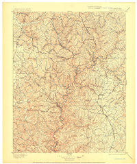
~ London KY topo map, 1:125000 scale, 30 X 30 Minute, Historical, 1897, updated 1904
London, Kentucky, USGS topographic map dated 1897.
Includes geographic coordinates (latitude and longitude). This topographic map is suitable for hiking, camping, and exploring, or framing it as a wall map.
Printed on-demand using high resolution imagery, on heavy weight and acid free paper, or alternatively on a variety of synthetic materials.
Topos available on paper, Waterproof, Poly, or Tyvek. Usually shipping rolled, unless combined with other folded maps in one order.
- Product Number: USGS-5294936
- Free digital map download (high-resolution, GeoPDF): London, Kentucky (file size: 7 MB)
- Map Size: please refer to the dimensions of the GeoPDF map above
- Weight (paper map): ca. 55 grams
- Map Type: POD USGS Topographic Map
- Map Series: HTMC
- Map Verison: Historical
- Cell ID: 65929
- Scan ID: 709142
- Imprint Year: 1904
- Survey Year: 1891
- Datum: Unstated
- Map Projection: Unstated
- Map published by United States Geological Survey
- Map Language: English
- Scanner Resolution: 508 dpi
- Map Cell Name: London
- Grid size: 30 X 30 Minute
- Date on map: 1897
- Map Scale: 1:125000
- Geographical region: Kentucky, United States
Neighboring Maps:
All neighboring USGS topo maps are available for sale online at a variety of scales.
Spatial coverage:
Topo map London, Kentucky, covers the geographical area associated the following places:
- Whetstone - Eberle - Peoples - Quail - Waneta - Squib - Ula - Livingston - Ottawa - Renfro Valley - Bernstadt - Mount Vernon - Hightop - Greenmount - Walnut Grove - Atlanta - Lantana (historical) - Maretburg - Sinks - Hare - Plato - Dry Hole (historical) - Cornette - McHargue - Willailla - East Bernstadt - Level Green - Old Bend (historical) - Burr - Clover Bottom - Holdams Mill (historical) - Flat Rock - Goodwater - Dry Fork (historical) - Symbol - Rice Hill (historical) - Welborn - Sandy Gap - Victory - Brodhead - Johnetta - Drum - Wellhope - Pittsburg - Laurel Branch (historical) - Hummel - Loam - Lamero - Goochland - Sand Springs - Turkeytown - Green Mountain (historical) - Keavy - Cooksburg - Colo - Acorn - Wabd - Boreing - Upper Indian Creek (historical) - Eglon - Threelinks - Poplarville - Climax - Pine Grove - Piney Grove - Seven Pines (historical) - Valley Oak - Pongo - Gum Sulphur - Mullins - Cruise - Fariston - Dykes - Pine Grove (historical) - Elrod - Pine Flat (historical) - Lily - Conrard - May - The Hazel Patch (historical) - Disputanta - Hurley - Hazel Patch - Cornelius - Dahl - Oakley - Roundstone - Dabolt - Shopville - Fall Lick (historical) - Mount Victory - Bloss - Flatton (historical) - Stab - Ardery (historical) - Hansford - Billows - Vanhook - London - Orlando
- Map Area ID: AREA37.537-84.5-84
- Northwest corner Lat/Long code: USGSNW37.5-84.5
- Northeast corner Lat/Long code: USGSNE37.5-84
- Southwest corner Lat/Long code: USGSSW37-84.5
- Southeast corner Lat/Long code: USGSSE37-84
- Northern map edge Latitude: 37.5
- Southern map edge Latitude: 37
- Western map edge Longitude: -84.5
- Eastern map edge Longitude: -84

