
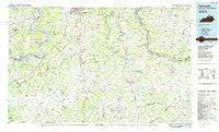
~ Falmouth KY topo map, 1:100000 scale, 30 X 60 Minute, Historical, 1986, updated 1986
Falmouth, Kentucky, USGS topographic map dated 1986.
Includes geographic coordinates (latitude and longitude). This topographic map is suitable for hiking, camping, and exploring, or framing it as a wall map.
Printed on-demand using high resolution imagery, on heavy weight and acid free paper, or alternatively on a variety of synthetic materials.
Topos available on paper, Waterproof, Poly, or Tyvek. Usually shipping rolled, unless combined with other folded maps in one order.
- Product Number: USGS-5294820
- Free digital map download (high-resolution, GeoPDF): Falmouth, Kentucky (file size: 15 MB)
- Map Size: please refer to the dimensions of the GeoPDF map above
- Weight (paper map): ca. 55 grams
- Map Type: POD USGS Topographic Map
- Map Series: HTMC
- Map Verison: Historical
- Cell ID: 67504
- Scan ID: 710068
- Imprint Year: 1986
- Woodland Tint: Yes
- Aerial Photo Year: 1983
- Edit Year: 1986
- Datum: NAD27
- Map Projection: Universal Transverse Mercator
- Planimetric: Yes
- Map published by United States Geological Survey
- Map Language: English
- Scanner Resolution: 508 dpi
- Map Cell Name: Falmouth
- Grid size: 30 X 60 Minute
- Date on map: 1986
- Map Scale: 1:100000
- Geographical region: Kentucky, United States
Neighboring Maps:
All neighboring USGS topo maps are available for sale online at a variety of scales.
Spatial coverage:
Topo map Falmouth, Kentucky, covers the geographical area associated the following places:
- Peach Grove - Hilltop - Dry Ridge (historical) - Augusta - Claysville - Cherry Grove - Springlake - Heekin - Maple Valley (historical) - Oakland (historical) - Devon - Yankeetown - Felicity - Kenton - Stringtown - Squiresville - Blackwell (historical) - Locust Ridge - Bracht - Abbott (historical) - Rabbit Hash - Old Sparta - Beaverlick - Pinhook - Norths Landing - Downingsville - Pleasant Home - Carntown - Moscow - Kensington - Taylor Mill - Fourmile (historical) - Mentor - Ethridge - Big Bend (historical) - Gardnersville - Brooksville - Caddo - Cumminsville - Ryle - Carson - Gubser Mill - Maple - Concord - Folsom - Long Ridge - Pleasant Ridge (historical) - Ridgeview Heights - Foster - Tarvan (historical) - Marcus - Hartford - Point Isabel - Four Oaks - Crittenden - Linville (historical) - Grants Lick - Meridian - Zion Station - Woolcott - Gurley Corner - Clermontville - Cedron - Saltair - Belmont (historical) - Lawrenceville - Campbells Block House (historical) - Berlin - Jericho - Willow Grove - Markland - Walton - Plum Creek (historical) - Hulington - Powersville - Butler - Perry Park - Kelat - Visalia - Four Corners - Belleview - Morgan - Napoleon - Florence - Milford - Browning Corner - Berry - The Wells (historical) - Wellsburg - Sugartit - California Crossing (historical) - California - Sanders - Caldwell - Mount Pisgah - Beagle - Northcutt - Hallam - Fairview - Dry Ridge
- Map Area ID: AREA3938.5-85-84
- Northwest corner Lat/Long code: USGSNW39-85
- Northeast corner Lat/Long code: USGSNE39-84
- Southwest corner Lat/Long code: USGSSW38.5-85
- Southeast corner Lat/Long code: USGSSE38.5-84
- Northern map edge Latitude: 39
- Southern map edge Latitude: 38.5
- Western map edge Longitude: -85
- Eastern map edge Longitude: -84


