
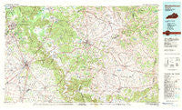
~ Elizabethtown KY topo map, 1:100000 scale, 30 X 60 Minute, Historical, 1981, updated 1983
Elizabethtown, Kentucky, USGS topographic map dated 1981.
Includes geographic coordinates (latitude and longitude). This topographic map is suitable for hiking, camping, and exploring, or framing it as a wall map.
Printed on-demand using high resolution imagery, on heavy weight and acid free paper, or alternatively on a variety of synthetic materials.
Topos available on paper, Waterproof, Poly, or Tyvek. Usually shipping rolled, unless combined with other folded maps in one order.
- Product Number: USGS-5294816
- Free digital map download (high-resolution, GeoPDF): Elizabethtown, Kentucky (file size: 19 MB)
- Map Size: please refer to the dimensions of the GeoPDF map above
- Weight (paper map): ca. 55 grams
- Map Type: POD USGS Topographic Map
- Map Series: HTMC
- Map Verison: Historical
- Cell ID: 67467
- Scan ID: 710066
- Imprint Year: 1983
- Woodland Tint: Yes
- Aerial Photo Year: 1979
- Edit Year: 1981
- Datum: NAD27
- Map Projection: Universal Transverse Mercator
- Map published by United States Geological Survey
- Map Language: English
- Scanner Resolution: 508 dpi
- Map Cell Name: Elizabethtown
- Grid size: 30 X 60 Minute
- Date on map: 1981
- Map Scale: 1:100000
- Geographical region: Kentucky, United States
Neighboring Maps:
All neighboring USGS topo maps are available for sale online at a variety of scales.
Spatial coverage:
Topo map Elizabethtown, Kentucky, covers the geographical area associated the following places:
- Stewarts Creek (historical) - McCauley (historical) - Leafdale - Hardesty - Gleanings - Bellwood - Coxs Creek - Bloomfield - Plum Run (historical) - Gethsemane - Beech Fork (historical) - Stiles - Sharpsville - Old Belmont (historical) - Hansbrough - Pleasant Run (historical) - Lagoon (historical) - Pulliam - Horseshoe Bend (historical) - Lebanon Junction - Dugan - Poplar Corner - Saint Charles - Cravens - Athertonville - Hilltop (historical) - West Point - Greenbrier - Springfield Pike (historical) - Samuel Pottinger Settlement (historical) - Gandertown - Indian Hills - Van Voorhis Manor - Lick Skillet (historical) - Penick - Thompsonville - Hahntown (historical) - Saint John - Calvary - Tablow - Fairview - Kraft - Riley - Red Hill - Hunters - Bourbon Springs - Howard - Cedar Grove - Gravel Switch - Helm (historical) - Saint Rose Pike (historical) - Monfort (historical) - Dietz Acres - Blue Gap - Star Mills - Nelsonville - Frogtown - Springfield - Scuffletown - Manton - South Bardstown (historical) - Fredericktown - Crest - Van Buren - White City (historical) - Attilla - Botland - Cherry Run (historical) - Humphrey (historical) - Bearwallow - Rineltown - Sparrow - Brush Grove - Briartown - Downs (historical) - Cardwell - Saint Joseph - Howardstown - Ashbrook - Holt Ridge (historical) - Jefferies (historical) - Poplar Level - Tatham Springs - Texas - Holy Cross - Glendale Junction - Needmore (historical) - Sinai - Longview Estates - Stewart - Barbours Mill Pike (historical) - Chaplin - Lower Logan (historical) - Polin - Vine Grove Junction - Cambron (historical) - Radcliff - New Hope - Bardstown - Deep Creek
- Map Area ID: AREA3837.5-86-85
- Northwest corner Lat/Long code: USGSNW38-86
- Northeast corner Lat/Long code: USGSNE38-85
- Southwest corner Lat/Long code: USGSSW37.5-86
- Southeast corner Lat/Long code: USGSSE37.5-85
- Northern map edge Latitude: 38
- Southern map edge Latitude: 37.5
- Western map edge Longitude: -86
- Eastern map edge Longitude: -85


