
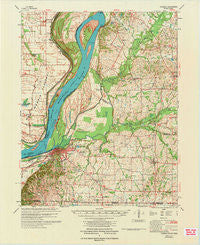
~ Hickman KY topo map, 1:62500 scale, 15 X 15 Minute, Historical, 1972
Hickman, Kentucky, USGS topographic map dated 1972.
Includes geographic coordinates (latitude and longitude). This topographic map is suitable for hiking, camping, and exploring, or framing it as a wall map.
Printed on-demand using high resolution imagery, on heavy weight and acid free paper, or alternatively on a variety of synthetic materials.
Topos available on paper, Waterproof, Poly, or Tyvek. Usually shipping rolled, unless combined with other folded maps in one order.
- Product Number: USGS-5294444
- Free digital map download (high-resolution, GeoPDF): Hickman, Kentucky (file size: 5 MB)
- Map Size: please refer to the dimensions of the GeoPDF map above
- Weight (paper map): ca. 55 grams
- Map Type: POD USGS Topographic Map
- Map Series: HTMC
- Map Verison: Historical
- Cell ID: 55311
- Scan ID: 803620
- Woodland Tint: Yes
- Aerial Photo Year: 1969
- Field Check Year: 1970
- Datum: NAD27
- Map Projection: Polyconic
- Map published by United States Army Corps of Engineers
- Map Language: English
- Scanner Resolution: 508 dpi
- Map Cell Name: Hickman
- Grid size: 15 X 15 Minute
- Date on map: 1972
- Map Scale: 1:62500
- Geographical region: Kentucky, United States
Neighboring Maps:
All neighboring USGS topo maps are available for sale online at a variety of scales.
Spatial coverage:
Topo map Hickman, Kentucky, covers the geographical area associated the following places:
- Moss (historical) - Oakton - Walnut Grove (historical) - Scott - Dorena - Moscow - Midway (historical) - Beech Grove (historical) - Hickman - Owens (historical) - Whaynes Corner - Ebenezer (historical) - New Chapel (historical) - Tar Heel - Stubbs - Wolf Island - Jordan - Liberty (historical) - Zion (historical) - Cayce - Brownsville - Hailwell - Dorena Landing - Bluff - South Columbus
- Map Area ID: AREA36.7536.5-89.25-89
- Northwest corner Lat/Long code: USGSNW36.75-89.25
- Northeast corner Lat/Long code: USGSNE36.75-89
- Southwest corner Lat/Long code: USGSSW36.5-89.25
- Southeast corner Lat/Long code: USGSSE36.5-89
- Northern map edge Latitude: 36.75
- Southern map edge Latitude: 36.5
- Western map edge Longitude: -89.25
- Eastern map edge Longitude: -89


