
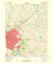
~ Lexington East KY topo map, 1:24000 scale, 7.5 X 7.5 Minute, Historical, 1959, updated 1960
Lexington East, Kentucky, USGS topographic map dated 1959.
Includes geographic coordinates (latitude and longitude). This topographic map is suitable for hiking, camping, and exploring, or framing it as a wall map.
Printed on-demand using high resolution imagery, on heavy weight and acid free paper, or alternatively on a variety of synthetic materials.
Topos available on paper, Waterproof, Poly, or Tyvek. Usually shipping rolled, unless combined with other folded maps in one order.
- Product Number: USGS-5291964
- Free digital map download (high-resolution, GeoPDF): Lexington East, Kentucky (file size: 11 MB)
- Map Size: please refer to the dimensions of the GeoPDF map above
- Weight (paper map): ca. 55 grams
- Map Type: POD USGS Topographic Map
- Map Series: HTMC
- Map Verison: Historical
- Cell ID: 25595
- Scan ID: 709101
- Imprint Year: 1960
- Woodland Tint: Yes
- Aerial Photo Year: 1949
- Edit Year: 1959
- Field Check Year: 1950
- Datum: NAD27
- Map Projection: Polyconic
- Map published by United States Geological Survey
- Map Language: English
- Scanner Resolution: 508 dpi
- Map Cell Name: Lexington East
- Grid size: 7.5 X 7.5 Minute
- Date on map: 1959
- Map Scale: 1:24000
- Geographical region: Kentucky, United States
Neighboring Maps:
All neighboring USGS topo maps are available for sale online at a variety of scales.
Spatial coverage:
Topo map Lexington East, Kentucky, covers the geographical area associated the following places:
- Idle Hour - Brighton - Eastland Park - Montclair - Ashland Park - Muir - Radcliffe - Bryan Station - Elkhorn Parks - Hi-Acres - Walnut Hill - Warrenton - Mount Vernon - Deep Springs - Chevy Chase - Elmendorf - Lexington Manor - Shadeland - Kenawood - Dixie Plantation - Lakeview Acres - Northland - Hermitage Hills - Liberty Heights - Russell Cave - Eastland - Hollywood - Montrose - Kingston - Rockwood - Lexington-Fayette - Pinehurst - Fairway - Thoroughbred Acres - Cadentown
- Map Area ID: AREA38.12538-84.5-84.375
- Northwest corner Lat/Long code: USGSNW38.125-84.5
- Northeast corner Lat/Long code: USGSNE38.125-84.375
- Southwest corner Lat/Long code: USGSSW38-84.5
- Southeast corner Lat/Long code: USGSSE38-84.375
- Northern map edge Latitude: 38.125
- Southern map edge Latitude: 38
- Western map edge Longitude: -84.5
- Eastern map edge Longitude: -84.375


