
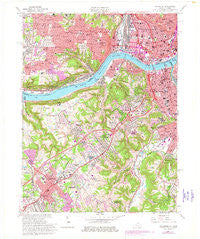
~ Covington KY topo map, 1:24000 scale, 7.5 X 7.5 Minute, Historical, 1961, updated 1978
Covington, Kentucky, USGS topographic map dated 1961.
Includes geographic coordinates (latitude and longitude). This topographic map is suitable for hiking, camping, and exploring, or framing it as a wall map.
Printed on-demand using high resolution imagery, on heavy weight and acid free paper, or alternatively on a variety of synthetic materials.
Topos available on paper, Waterproof, Poly, or Tyvek. Usually shipping rolled, unless combined with other folded maps in one order.
- Product Number: USGS-5290372
- Free digital map download (high-resolution, GeoPDF): Covington, Kentucky (file size: 14 MB)
- Map Size: please refer to the dimensions of the GeoPDF map above
- Weight (paper map): ca. 55 grams
- Map Type: POD USGS Topographic Map
- Map Series: HTMC
- Map Verison: Historical
- Cell ID: 10402
- Scan ID: 708442
- Imprint Year: 1978
- Woodland Tint: Yes
- Photo Revision Year: 1969
- Aerial Photo Year: 1969
- Edit Year: 1961
- Field Check Year: 1953
- Datum: NAD27
- Map Projection: Polyconic
- Map published by United States Geological Survey
- Map Language: English
- Scanner Resolution: 508 dpi
- Map Cell Name: Covington
- Grid size: 7.5 X 7.5 Minute
- Date on map: 1961
- Map Scale: 1:24000
- Geographical region: Kentucky, United States
Neighboring Maps:
All neighboring USGS topo maps are available for sale online at a variety of scales.
Spatial coverage:
Topo map Covington, Kentucky, covers the geographical area associated the following places:
- Little Buck (historical) - Maurice - Edgewood - Crescent Park - Laurel Homes - Kenton Vale - Saint Lawrence Corners - Barrsville - Latonia Terrace - Fort Mitchell - Jacob Price Homes - Crestview Hills - East Price Hill - Sanfordtown (historical) - Amsterdam (historical) - Highland Park - Mount Auburn - Bromley - Crescent Springs - Lookout Heights - Over-The-Rhine - Forest Hills - Sanfordtown - Sedamsville - Covedale - Latonia - Covington - Prospect Hill - Cloud City (historical) - Bucktown (historical) - Park Hills - Jerusalem - Lincoln Court - Ludlow - Sandfordtown (historical) - Erlanger - Delhi Hills - Frenchmens Corner (historical) - Lakeside Park - Brighton Corner - Marydale - West Covington - Villa Hills - Storrs - West Covington (historical) - Winston Park - Elsmere - Mount Harrison - Placid Meadows - Price Hill - Fashion Heights - Monterey - Summit Hills Heights - South Fort Mitchell - Lakeview - Delhi - Fort Wright - Lower Price Hill - Eileen Gardens - Little Bethlehem - Riverside - Kenton Hills - West Price Hill - Anderson Ferry
- Map Area ID: AREA39.12539-84.625-84.5
- Northwest corner Lat/Long code: USGSNW39.125-84.625
- Northeast corner Lat/Long code: USGSNE39.125-84.5
- Southwest corner Lat/Long code: USGSSW39-84.625
- Southeast corner Lat/Long code: USGSSE39-84.5
- Northern map edge Latitude: 39.125
- Southern map edge Latitude: 39
- Western map edge Longitude: -84.625
- Eastern map edge Longitude: -84.5


