
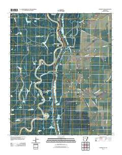
~ Henrico NE AR topo map, 1:24000 scale, 7.5 X 7.5 Minute, Historical, 2011
Henrico NE, Arkansas, USGS topographic map dated 2011.
Includes geographic coordinates (latitude and longitude). This topographic map is suitable for hiking, camping, and exploring, or framing it as a wall map.
Printed on-demand using high resolution imagery, on heavy weight and acid free paper, or alternatively on a variety of synthetic materials.
Topos available on paper, Waterproof, Poly, or Tyvek. Usually shipping rolled, unless combined with other folded maps in one order.
- Product Number: USGS-5289370
- Free digital map download (high-resolution, GeoPDF): Henrico NE, Arkansas (file size: 23 MB)
- Map Size: please refer to the dimensions of the GeoPDF map above
- Weight (paper map): ca. 55 grams
- Map Type: POD USGS Topographic Map
- Map Series: US Topo
- Map Verison: Historical
- Cell ID: 20114
- Datum: North American Datum of 1983
- Map Projection: Transverse Mercator
- Map Cell Name: Henrico NE
- Grid size: 7.5 X 7.5 Minute
- Date on map: 2011
- Map Scale: 1:24000
- Geographical region: Arkansas, United States
Neighboring Maps:
All neighboring USGS topo maps are available for sale online at a variety of scales.
Spatial coverage:
Topo map Henrico NE, Arkansas, covers the geographical area associated the following places:
- Hudsons Landing Campground - South Fork Bee Bayou - H Lake - Round Lake - North Fork Bee Bayou - Upper Taylor Lake - Tupelo Lake - Cocklebur Slough - Scrubgrass Bayou - Bee Bayou - Little H Lake - Flat Lake - Burnt Lake (historical) - Escronges Lake - Willow Lake - Flat Lake - Middle Bayou - H Lake Landing - Jackass Point - Bradley Bayou - Long Lake - Steelman Lake - T Lake - Little Bee Bayou - Bear Lake - Mobley Lake - Fish Lake - Crane Lake - Columbus Lake - Little Island Bayou - Little Island - Brushy Slough - Girard Reach - Star Lake - Mud Lakes - Pennyson Lake (historical) - Lake Bayou - Cypress Bayou - Horseshoe Lake - Gum Pond - Lower White Lake - Mussell Point - Prairie Lake - Wamac Point - Burnt Lake - Little Goose Lake
- Map Area ID: AREA34.2534.125-91.125-91
- Northwest corner Lat/Long code: USGSNW34.25-91.125
- Northeast corner Lat/Long code: USGSNE34.25-91
- Southwest corner Lat/Long code: USGSSW34.125-91.125
- Southeast corner Lat/Long code: USGSSE34.125-91
- Northern map edge Latitude: 34.25
- Southern map edge Latitude: 34.125
- Western map edge Longitude: -91.125
- Eastern map edge Longitude: -91


