
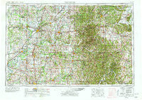
~ Vincennes IN topo map, 1:250000 scale, 1 X 2 Degree, Historical, 1956, updated 1978
Vincennes, Indiana, USGS topographic map dated 1956.
Includes geographic coordinates (latitude and longitude). This topographic map is suitable for hiking, camping, and exploring, or framing it as a wall map.
Printed on-demand using high resolution imagery, on heavy weight and acid free paper, or alternatively on a variety of synthetic materials.
Topos available on paper, Waterproof, Poly, or Tyvek. Usually shipping rolled, unless combined with other folded maps in one order.
- Product Number: USGS-5289260
- Free digital map download (high-resolution, GeoPDF): Vincennes, Indiana (file size: 21 MB)
- Map Size: please refer to the dimensions of the GeoPDF map above
- Weight (paper map): ca. 55 grams
- Map Type: POD USGS Topographic Map
- Map Series: HTMC
- Map Verison: Historical
- Cell ID: 69083
- Scan ID: 160319
- Imprint Year: 1978
- Woodland Tint: Yes
- Visual Version Number: 1
- Photo Revision Year: 1969
- Aerial Photo Year: 1952
- Edit Year: 1969
- Field Check Year: 1956
- Datum: Unstated
- Map Projection: Transverse Mercator
- Map published by United States Geological Survey
- Map Language: English
- Scanner Resolution: 600 dpi
- Map Cell Name: Vincennes
- Grid size: 1 X 2 Degree
- Date on map: 1956
- Map Scale: 1:250000
- Geographical region: Indiana, United States
Neighboring Maps:
All neighboring USGS topo maps are available for sale online at a variety of scales.
Spatial coverage:
Topo map Vincennes, Indiana, covers the geographical area associated the following places:
- Curby - Oriole - Avoca - Lyons - Saint Meinrad - Bandon - Jericho - Weddleville - Ewing - Bellmont - Thales - Heathsville - Hancock Chapel - Campbelltown - Graham - Riverview - Fritz Corner - Charlottsville (historical) - Mott Station - Princeton - Pinkstaff - Oil Grove - Waco - Natchez - Rosebud - Savah - Mooleyville - Spring Mill Village - Maysville - Johnson - Melody Hill - Kurtz - Buckskin - Riddleville - Byrneville - Norman - Durham - West Baden Springs - Santa Claus - Mitchell - Scottsburg - Vallonia - Owensburg - Lodale - Acme - Purcell - Doolittle Mills - Alford - Elnora - Derby - Spurgeon - Hitchcock - Bartons Location - Crane - Rumble - Fisherville - Union - Farlen - Fritchton - Green Brier - Scenic Hill - Red Hill - Rehoboth - Dogwood - Dubois Crossroads - Keensburg - Earle - Lincoln City - Marco - Woodville - Wheatland - Bedford - Vincennes - Selvin - Murdock - Jasper - Roberta - Haubstadt - Yenne - Claremont - Tunnelton - Saint John - Pleasantville - Loogootee - Liberty - Montgomery - Bloods Wood Crossing - Chambersburg - Prospect - Villas - Hobbieville - Indian Springs - Chenaultt - Hartleyville - Greenbrier - Brownstown - Loafers Station - Fairdale - Chauncey - Davy
- Map Area ID: AREA3938-88-86
- Northwest corner Lat/Long code: USGSNW39-88
- Northeast corner Lat/Long code: USGSNE39-86
- Southwest corner Lat/Long code: USGSSW38-88
- Southeast corner Lat/Long code: USGSSE38-86
- Northern map edge Latitude: 39
- Southern map edge Latitude: 38
- Western map edge Longitude: -88
- Eastern map edge Longitude: -86


