
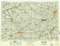
~ Muncie IN topo map, 1:250000 scale, 1 X 2 Degree, Historical, 1956
Muncie, Indiana, USGS topographic map dated 1956.
Includes geographic coordinates (latitude and longitude). This topographic map is suitable for hiking, camping, and exploring, or framing it as a wall map.
Printed on-demand using high resolution imagery, on heavy weight and acid free paper, or alternatively on a variety of synthetic materials.
Topos available on paper, Waterproof, Poly, or Tyvek. Usually shipping rolled, unless combined with other folded maps in one order.
- Product Number: USGS-5289252
- Free digital map download (high-resolution, GeoPDF): Muncie, Indiana (file size: 14 MB)
- Map Size: please refer to the dimensions of the GeoPDF map above
- Weight (paper map): ca. 55 grams
- Map Type: POD USGS Topographic Map
- Map Series: HTMC
- Map Verison: Historical
- Cell ID: 68926
- Scan ID: 160082
- Woodland Tint: Yes
- Aerial Photo Year: 1952
- Datum: Unstated
- Map Projection: Transverse Mercator
- Map published by United States Army
- Map Language: English
- Scanner Resolution: 600 dpi
- Map Cell Name: Muncie
- Grid size: 1 X 2 Degree
- Date on map: 1956
- Map Scale: 1:250000
- Geographical region: Indiana, United States
Neighboring Maps:
All neighboring USGS topo maps are available for sale online at a variety of scales.
Spatial coverage:
Topo map Muncie, Indiana, covers the geographical area associated the following places:
- Hoaglin - Casstown - Wakefield - Jonesboro - Shady Hills - Saint Johns - Irondale - MacAdam (historical) - Lees Landing - Celina - South Edgewood - Southworth - Palestine - Haven View - Santa Fe - Duckfoot Landing - Morris Trailer Park - Coletown - Wabash - Geyer - North Anderson - Sims - Ridertown - Phlox - Shamrock Lakes - Muntanna - Strakers (historical) - McCartyville - Pasco - Boundary City - Hume - Fox Harbor - Drew - Bali Hai Mobile Home Park - Montezuma - Ridgeville - Lake Wood - Jimtown (historical) - Colonial Estates - Progress - Chesterfield - Radley - Convoy - Weavers - Van Wert - Stanfield Place - Elm Tree Crossroads - Allentown - Stemen's Mobile Manor - Craigville - Nottinghill - Brookside - Newton - Stelvideo - Hunters Run - Converse Station - Middle Point - Middlebury - Gilman - Coppess Corner - Greenville - Salamonia - Poe - Greenwood - Mount Summit - Clark - Sandy Beach - River - Pattytown - Huntington - Modoc - Rogersville - Stockport - Eldean - West Covington - Rigdon - Ossian - Browns Corner - Snow Hill - Sweetser - Pemberton - Fourmans Corners - Fort Shawnee - Pikeville - Laine Trailer Park - Aroma - Pleasant Ridge - Montpelier - Jerome - Do Well Mobile Village - Converse - Breezewood - New Columbus - Fishersburg - Omega - Stonebridge - Westside Mobile Home Community - Steinman (historical) - Bellfountain - Willowcreek
- Map Area ID: AREA4140-86-84
- Northwest corner Lat/Long code: USGSNW41-86
- Northeast corner Lat/Long code: USGSNE41-84
- Southwest corner Lat/Long code: USGSSW40-86
- Southeast corner Lat/Long code: USGSSE40-84
- Northern map edge Latitude: 41
- Southern map edge Latitude: 40
- Western map edge Longitude: -86
- Eastern map edge Longitude: -84


