
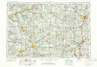
~ Muncie IN topo map, 1:250000 scale, 1 X 2 Degree, Historical, 1953, updated 1966
Muncie, Indiana, USGS topographic map dated 1953.
Includes geographic coordinates (latitude and longitude). This topographic map is suitable for hiking, camping, and exploring, or framing it as a wall map.
Printed on-demand using high resolution imagery, on heavy weight and acid free paper, or alternatively on a variety of synthetic materials.
Topos available on paper, Waterproof, Poly, or Tyvek. Usually shipping rolled, unless combined with other folded maps in one order.
- Product Number: USGS-5289250
- Free digital map download (high-resolution, GeoPDF): Muncie, Indiana (file size: 15 MB)
- Map Size: please refer to the dimensions of the GeoPDF map above
- Weight (paper map): ca. 55 grams
- Map Type: POD USGS Topographic Map
- Map Series: HTMC
- Map Verison: Historical
- Cell ID: 68926
- Scan ID: 160081
- Imprint Year: 1966
- Woodland Tint: Yes
- Aerial Photo Year: 1952
- Edit Year: 1965
- Datum: Unstated
- Map Projection: Transverse Mercator
- Map published by United States Geological Survey
- Map Language: English
- Scanner Resolution: 600 dpi
- Map Cell Name: Muncie
- Grid size: 1 X 2 Degree
- Date on map: 1953
- Map Scale: 1:250000
- Geographical region: Indiana, United States
Neighboring Maps:
All neighboring USGS topo maps are available for sale online at a variety of scales.
Spatial coverage:
Topo map Muncie, Indiana, covers the geographical area associated the following places:
- Culbertson Heights - Alcony - Parker City - Sodom (historical) - Macedon - Recks Trailer Park - Oakville - Bell Avenue Trailer Court - Arcana - Valley Brook - Chickasaw - Twin Lakes (historical) - Southmoor Shores - Sherwood Forest - Converse Station - Forest Hills - Hawk Cove - Weavers - Scudder - Rowdyville (historical) - New Burlington - Concord - Lagro - Elmhurst - Burkettsville - Irvington - College Corner - Crestwood Mobile Home Park - Sampson (historical) - Geneva - Riverwood - Selma - Creston - Uniopolis - Glyn Ellen - Mahon - Boston Corner - Richey - Elgin - Michaelsville - Bursville - Hawks Nest - Meadows Knoll - Woodland Park - Fowlerton - Needmore - Unionport - Ulm's Mobile Home Court II - Rigdon - Broad Acres - Fiat - D and S Mobile Village - College Corner - Poplar Ridge - Houston - Green Acres - Wildcat Woods Estates - Steinman (historical) - Duckfoot Landing - Frankton - Matthews - Linn Grove - Salem - Tama - Lakeland Beach - Abbottsville - Erie - Lock Two - Hartford (historical) - New Harrison - Oakmont Creek - Landess - Whitackers Court - Trenton - Fox Harbor - Westside Mobile Home Community - Hunters Chase - Moulton - Liberty Center - Bellfountain - Jimtown (historical) - Bryant - Villa Nova - Slater - East Liberty - Hill Grove - Edgewood Village - Casstown - Needmore (historical) - Laketon - Sleepy Hollow Acres - Losantville - Country Club Heights - Pusheta Town (historical) - Woodington - Spencerville - Cowan - Fairfax - Noble - Wetzel
- Map Area ID: AREA4140-86-84
- Northwest corner Lat/Long code: USGSNW41-86
- Northeast corner Lat/Long code: USGSNE41-84
- Southwest corner Lat/Long code: USGSSW40-86
- Southeast corner Lat/Long code: USGSSE40-84
- Northern map edge Latitude: 41
- Southern map edge Latitude: 40
- Western map edge Longitude: -86
- Eastern map edge Longitude: -84


