
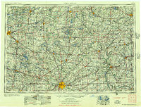
~ Fort Wayne IN topo map, 1:250000 scale, 1 X 2 Degree, Historical, 1956
Fort Wayne, Indiana, USGS topographic map dated 1956.
Includes geographic coordinates (latitude and longitude). This topographic map is suitable for hiking, camping, and exploring, or framing it as a wall map.
Printed on-demand using high resolution imagery, on heavy weight and acid free paper, or alternatively on a variety of synthetic materials.
Topos available on paper, Waterproof, Poly, or Tyvek. Usually shipping rolled, unless combined with other folded maps in one order.
- Product Number: USGS-5289232
- Free digital map download (high-resolution, GeoPDF): Fort Wayne, Indiana (file size: 16 MB)
- Map Size: please refer to the dimensions of the GeoPDF map above
- Weight (paper map): ca. 55 grams
- Map Type: POD USGS Topographic Map
- Map Series: HTMC
- Map Verison: Historical
- Cell ID: 68788
- Scan ID: 156494
- Woodland Tint: Yes
- Aerial Photo Year: 1952
- Field Check Year: 1953
- Datum: Unstated
- Map Projection: Transverse Mercator
- Map published by United States Geological Survey
- Map Language: English
- Scanner Resolution: 600 dpi
- Map Cell Name: Fort Wayne
- Grid size: 1 X 2 Degree
- Date on map: 1956
- Map Scale: 1:250000
- Geographical region: Indiana, United States
Neighboring Maps:
All neighboring USGS topo maps are available for sale online at a variety of scales.
Spatial coverage:
Topo map Fort Wayne, Indiana, covers the geographical area associated the following places:
- Jewell - Wisterman - Batavia Center - Bryan Mobile Home Park - Plattston (historical) - Washington Center - Vistula - Twin Lakes Trailer Court - Kendallville - Cloverleaf (historical) - Country Club Gardens - Baldwin (historical) - Oak Lodge - Hartzel - Cold Springs - Allenton - Florida - Renollet (historical) - Westmoor - Fountain Park - Hector - Liberty Hills - Eagle Point - Ormas - Bluff Beach - Sand Creek - Howe - Butler Center - Calvin Center - Spring Beach - Clarks Landing - Colonial Manor Mobile Home Park - Stroh - Ney - Burket - Fort Wayne - West Woodly Addition - Fountain Park - Rome City - Pittsford - Wawasee Village - Colon - Damascus (historical) - Geneva - Woodburn - Saint Andrews (historical) - Winona Lake - Adrian - Worstville - Canada Shores - Ball Subdivision - Lorane - Glenburg (historical) - Circle Park - Northwest - Jerrys First Addition - Forest Ridge - Burr Oak - Tunker - North Morenci - Eastland Gardens - Gallup - Holly Addition - Adamsville - Adams Ridge - Stryker Trailer Park - Corey - Mandale - Lime Creek - Tree Meadows Mobile Home Park - Melbern - Hursh - Timber Creek - Five Points - Corunna - Lakeview Spring - Advance - DeFries Landing - Inverness - Forest Park - McDonald Subdivision - Barbee - Bona Vesta - Pleasant Bend - The Bend - Stoneburner Landing - Latty - Findley - Alvarado - Shipshewana - Goshen - Townley - Redmon Park - Countryside Mobile Court - Maple Grove Trailer Park - Arthur - Canalport - Cicero (historical) - Madison Center - Epworth Forest
- Map Area ID: AREA4241-86-84
- Northwest corner Lat/Long code: USGSNW42-86
- Northeast corner Lat/Long code: USGSNE42-84
- Southwest corner Lat/Long code: USGSSW41-86
- Southeast corner Lat/Long code: USGSSE41-84
- Northern map edge Latitude: 42
- Southern map edge Latitude: 41
- Western map edge Longitude: -86
- Eastern map edge Longitude: -84


