
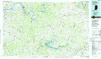
~ Tell City IN topo map, 1:100000 scale, 30 X 60 Minute, Historical, 1986, updated 1986
Tell City, Indiana, USGS topographic map dated 1986.
Includes geographic coordinates (latitude and longitude). This topographic map is suitable for hiking, camping, and exploring, or framing it as a wall map.
Printed on-demand using high resolution imagery, on heavy weight and acid free paper, or alternatively on a variety of synthetic materials.
Topos available on paper, Waterproof, Poly, or Tyvek. Usually shipping rolled, unless combined with other folded maps in one order.
- Product Number: USGS-5289196
- Free digital map download (high-resolution, GeoPDF): Tell City, Indiana (file size: 16 MB)
- Map Size: please refer to the dimensions of the GeoPDF map above
- Weight (paper map): ca. 55 grams
- Map Type: POD USGS Topographic Map
- Map Series: HTMC
- Map Verison: Historical
- Cell ID: 68445
- Scan ID: 156147
- Imprint Year: 1986
- Woodland Tint: Yes
- Aerial Photo Year: 1983
- Edit Year: 1986
- Datum: NAD27
- Map Projection: Universal Transverse Mercator
- Planimetric: Yes
- Map published by United States Geological Survey
- Map Language: English
- Scanner Resolution: 600 dpi
- Map Cell Name: Tell City
- Grid size: 30 X 60 Minute
- Date on map: 1986
- Map Scale: 1:100000
- Geographical region: Indiana, United States
Neighboring Maps:
All neighboring USGS topo maps are available for sale online at a variety of scales.
Spatial coverage:
Topo map Tell City, Indiana, covers the geographical area associated the following places:
- Stephensport - Mook - Limp - Petri - Eastwood Hills - Adaburg - Corners - Tousey - Westview - Flaherty - Preston (historical) - Summit - Graysville - Saint Lawrence (historical) - Scuffletown (historical) - Perryville - Rosetta - Brandenburg Station - Goering - Short Creek - Ellmitch - Sunnydale - Custer - Patesville - Arnold (historical) - Howe Valley - Gurley Landing - Ekron - Mystic - McDaniels - Olaton - Lilac - Centerview - Big Spring - Midway (historical) - Chestnut Grove (historical) - Manning Crossing - Addison - Victoria Crossroads - Vanzant - Grandview - Woodrow - Deanefield - Laffoon - Habit - Lickskillet - Oak Ridge (historical) - Hardin Springs - Ammons - Taffy - Haynesville - Sulphur Springs - Tell City - Webster - Whitesville - West Clifty - Sunny Corner - Harcourt - Buford - Fisher - Hillgrove - Hardingrove - Grahamton - Kirk - Rome - Maples Corner - Lilmay (historical) - Sanders - Skillman - Hinton Hills - Bells Run - Easton - Glen Dean - Haywood Chapel (historical) - Davidson - Roff - Askin - Gatewood - Four Corners - Tywhapity Bottoms (historical) - Union Star - Rock Haven - Narrows - Garrett - Philpot - Indian Valley - Weberstown - Doe Valley - Knottsville - Madrid - Kingswood - Pellville - Lee (historical) - Guston - Duff - Rockvale - Arrington Corner - Hickory Corner - Bethlehem (historical) - Cullen (historical)
- Map Area ID: AREA3837.5-87-86
- Northwest corner Lat/Long code: USGSNW38-87
- Northeast corner Lat/Long code: USGSNE38-86
- Southwest corner Lat/Long code: USGSSW37.5-87
- Southeast corner Lat/Long code: USGSSE37.5-86
- Northern map edge Latitude: 38
- Southern map edge Latitude: 37.5
- Western map edge Longitude: -87
- Eastern map edge Longitude: -86


