
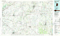
~ New Castle IN topo map, 1:100000 scale, 30 X 60 Minute, Historical, 1986, updated 1986
New Castle, Indiana, USGS topographic map dated 1986.
Includes geographic coordinates (latitude and longitude). This topographic map is suitable for hiking, camping, and exploring, or framing it as a wall map.
Printed on-demand using high resolution imagery, on heavy weight and acid free paper, or alternatively on a variety of synthetic materials.
Topos available on paper, Waterproof, Poly, or Tyvek. Usually shipping rolled, unless combined with other folded maps in one order.
- Product Number: USGS-5289184
- Free digital map download (high-resolution, GeoPDF): New Castle, Indiana (file size: 16 MB)
- Map Size: please refer to the dimensions of the GeoPDF map above
- Weight (paper map): ca. 55 grams
- Map Type: POD USGS Topographic Map
- Map Series: HTMC
- Map Verison: Historical
- Cell ID: 68040
- Scan ID: 159312
- Imprint Year: 1986
- Woodland Tint: Yes
- Aerial Photo Year: 1984
- Edit Year: 1986
- Datum: NAD27
- Map Projection: Universal Transverse Mercator
- Planimetric: Yes
- Map published by United States Geological Survey
- Map Language: English
- Scanner Resolution: 600 dpi
- Map Cell Name: New Castle
- Grid size: 30 X 60 Minute
- Date on map: 1986
- Map Scale: 1:100000
- Geographical region: Indiana, United States
Neighboring Maps:
All neighboring USGS topo maps are available for sale online at a variety of scales.
Spatial coverage:
Topo map New Castle, Indiana, covers the geographical area associated the following places:
- Hoover Mill - Rushville - Valley Farms Estates - Fairland - Burge Terrace - Sterling Green - Charlottesville - Lewisville - Cumberland Woods - The Springs of Cambridge - Reds Corner - Chateau Court - Sandstone Woods - Bowman Acres - Henderson - Mount Comfort - Fayne Siding - Laurel - Willow Branch - Milners Corner - Glen Abbey At Windermere - The Anchorage - Sun Down - Blue Ridge - Ashwood - Warrington - Gwynneville - Bradford Court - Schildmeier Park - Windjammer - Circleville - Mooreland - Tremont - Huber - Breakwater - McCordsville - Spiceland - Olio - Sandstone Lakes - Grant City - Freeport - Maple Valley - Luxhaven - Riley Village - Hillsborough - Falmouth - Spyglass Hill - Alquina - Brownsville - Fountaintown - Raleigh - Philomath - Rainbow Highlands - Spring Lake - Wilkinson - Reedville Station - Sugar Creek - Oaklandon - New Lisbon - Fortville - Charle Sumac Estates - Plantana - Masthead - Trilobi Hills - Carrollton - Cumberland Ridge - Germantown - Gem - Sulphur Spring - College Corner - Heritage Green - Needham - Mount Auburn - Bucks Creek - Indigo Lake - East Germantown - Van Nuys - Pennville - Walnut Hills - Hiser - Bentonville - Nashville - Stone Quarry Mills - Britton Ridge - Fairview - Rays Crossing - Brookville Heights - Brookston Place - Wellington Heights - Waterloo - Candleglo Village - Mount Auburn - Charlesmac Village - Henry - Pleasant View - Carefree Estates - Alfont - Farmington - Ingalls - Knox
- Map Area ID: AREA4039.5-86-85
- Northwest corner Lat/Long code: USGSNW40-86
- Northeast corner Lat/Long code: USGSNE40-85
- Southwest corner Lat/Long code: USGSSW39.5-86
- Southeast corner Lat/Long code: USGSSE39.5-85
- Northern map edge Latitude: 40
- Southern map edge Latitude: 39.5
- Western map edge Longitude: -86
- Eastern map edge Longitude: -85


