
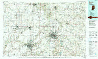
~ Muncie IN topo map, 1:100000 scale, 30 X 60 Minute, Historical, 1986, updated 1990
Muncie, Indiana, USGS topographic map dated 1986.
Includes geographic coordinates (latitude and longitude). This topographic map is suitable for hiking, camping, and exploring, or framing it as a wall map.
Printed on-demand using high resolution imagery, on heavy weight and acid free paper, or alternatively on a variety of synthetic materials.
Topos available on paper, Waterproof, Poly, or Tyvek. Usually shipping rolled, unless combined with other folded maps in one order.
- Product Number: USGS-5289178
- Free digital map download (high-resolution, GeoPDF): Muncie, Indiana (file size: 21 MB)
- Map Size: please refer to the dimensions of the GeoPDF map above
- Weight (paper map): ca. 55 grams
- Map Type: POD USGS Topographic Map
- Map Series: HTMC
- Map Verison: Historical
- Cell ID: 68016
- Scan ID: 156025
- Imprint Year: 1990
- Woodland Tint: Yes
- Aerial Photo Year: 1983
- Edit Year: 1986
- Datum: NAD27
- Map Projection: Universal Transverse Mercator
- Map published by United States Geological Survey
- Map Language: English
- Scanner Resolution: 600 dpi
- Map Cell Name: Muncie
- Grid size: 30 X 60 Minute
- Date on map: 1986
- Map Scale: 1:100000
- Geographical region: Indiana, United States
Neighboring Maps:
All neighboring USGS topo maps are available for sale online at a variety of scales.
Spatial coverage:
Topo map Muncie, Indiana, covers the geographical area associated the following places:
- Royerton - Maxville - Aroma - Grandview - Mechanicsburg - Frankton - Linwood - New Lancaster - Curtisville - College Corner - New Mount Pleasant - Alliance - Hyde Park - Scott Corner - Wheeling - Andersonville - Corkwell - West Liberty - Chesterfield - Buena Vista - Sulphur Springs - Stone - Renner - Western Village - Summitville - Country Club Heights - Normal - Florida - Alexandria - Matthews - Muncie - Irvington - Forest Hills - Clarksville - Windsor - Hobbs - Gridley - Liberty Corners - Gaston - Mount Pleasant - Creston - Drew - Pony - Modoc - Durbin - Emporia - Ridgeville - Middletown - Middletown Park - Springport - Hartford City - Selma - Oakville - Extension Heights - Elwood - Ridertown - Edgewood - Losantville - Sycamore - Yorktown - Gimco City - South Elwood - Mayfield - Perkinsville - Leisure - Omega - River Forest - Converse - Medford - Pinch - Trenton - Stockport - Blaine - Radley - Desoto - Hardscrabble - Glyn Ellen - Anthony - Shideler - Fairmount - Gas City - Prosperity - Rigdon - New Burlington - Moonville - Irondale - Reed Station - Pennville - Woodland Park - Shedville - Greentown - Elmhurst - Point Isabel - Bethel - Upland - Kitt - Phlox - Strawtown - Morningside - Fowlerton
- Map Area ID: AREA40.540-86-85
- Northwest corner Lat/Long code: USGSNW40.5-86
- Northeast corner Lat/Long code: USGSNE40.5-85
- Southwest corner Lat/Long code: USGSSW40-86
- Southeast corner Lat/Long code: USGSSE40-85
- Northern map edge Latitude: 40.5
- Southern map edge Latitude: 40
- Western map edge Longitude: -86
- Eastern map edge Longitude: -85


