
~ Lafayette IN topo map, 1:100000 scale, 30 X 60 Minute, Historical, 1984, updated 1994
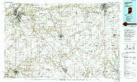
Lafayette, Indiana, USGS topographic map dated 1984.
Includes geographic coordinates (latitude and longitude). This topographic map is suitable for hiking, camping, and exploring, or framing it as a wall map.
Printed on-demand using high resolution imagery, on heavy weight and acid free paper, or alternatively on a variety of synthetic materials.
Topos available on paper, Waterproof, Poly, or Tyvek. Usually shipping rolled, unless combined with other folded maps in one order.
- Product Number: USGS-5289166
- Free digital map download (high-resolution, GeoPDF): Lafayette, Indiana (file size: 21 MB)
- Map Size: please refer to the dimensions of the GeoPDF map above
- Weight (paper map): ca. 55 grams
- Map Type: POD USGS Topographic Map
- Map Series: HTMC
- Map Verison: Historical
- Cell ID: 67787
- Scan ID: 156091
- Imprint Year: 1994
- Woodland Tint: Yes
- Photo Inspection Year: 1990
- Aerial Photo Year: 1983
- Edit Year: 1984
- Datum: NAD27
- Map Projection: Universal Transverse Mercator
- Map published by United States Geological Survey
- Map Language: English
- Scanner Resolution: 600 dpi
- Map Cell Name: Lafayette
- Grid size: 30 X 60 Minute
- Date on map: 1984
- Map Scale: 1:100000
- Geographical region: Indiana, United States
Neighboring Maps:
All neighboring USGS topo maps are available for sale online at a variety of scales.
Spatial coverage:
Topo map Lafayette, Indiana, covers the geographical area associated the following places:
- Monterey Village - Clarks Hill - Ellis - Nevada - Jefferson - Indian Heights - Pickard - Shadeland - Gadsden - Heath - Lamong - Beckville - Hamilton - Gladens Corner - Vermont - Hillisburg - Concord - Burlington - Crumb Corner - Hortonville - Stockwell - Linden - Hazelrigg - Mechanicsburg - Terhune - Birmingham - North Crane - Antioch - Tecumseh - Millersburg - Risse - Wilshire - Manchester - Tetersburg - Kokomo - Cicero - Cyclone - East Union - Pyrmont - Bowers - Taylor - Ulen - Ekin - Edna Mills - Buck Creek - Yountsville - Federal Hill - Beard - New Richmond - Lexington - Corwin - Elston - Avery - Deming - Waugh - Meadowbrook - Groomsville - Kempton - Dover - Smartsburg - Eastwitch - Pike - Monitor - Romney - Normanda - Mulberry - McQuinn Estates - Klondike - Shannondale - Tipton - Oakford - Ames - Rosston - Happy Hollow Heights - Monroe - Manson - Scircleville - Ockley - Delp - Russiaville - Bar-Barry Heights - Darlington Woods - Log Cabin Crossroads - Darrough Chapel - Green Meadows - Big Springs - Boyleston - West Middleton - Reagan - Fiskville - Cutler - Woodside Park - Elizaville - Wesley Manor - Michigantown - Ridgeway - Middlefork - Geetingsville - Dale - Summit
- Map Area ID: AREA40.540-87-86
- Northwest corner Lat/Long code: USGSNW40.5-87
- Northeast corner Lat/Long code: USGSNE40.5-86
- Southwest corner Lat/Long code: USGSSW40-87
- Southeast corner Lat/Long code: USGSSE40-86
- Northern map edge Latitude: 40.5
- Southern map edge Latitude: 40
- Western map edge Longitude: -87
- Eastern map edge Longitude: -86


