
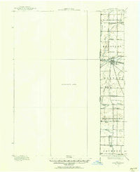
~ Fort Recovery OH topo map, 1:62500 scale, 15 X 15 Minute, Historical, 1915, updated 1957
Fort Recovery, Ohio, USGS topographic map dated 1915.
Includes geographic coordinates (latitude and longitude). This topographic map is suitable for hiking, camping, and exploring, or framing it as a wall map.
Printed on-demand using high resolution imagery, on heavy weight and acid free paper, or alternatively on a variety of synthetic materials.
Topos available on paper, Waterproof, Poly, or Tyvek. Usually shipping rolled, unless combined with other folded maps in one order.
- Product Number: USGS-5288996
- Free digital map download (high-resolution, GeoPDF): Fort Recovery, Ohio (file size: 3 MB)
- Map Size: please refer to the dimensions of the GeoPDF map above
- Weight (paper map): ca. 55 grams
- Map Type: POD USGS Topographic Map
- Map Series: HTMC
- Map Verison: Historical
- Cell ID: 54292
- Scan ID: 156481
- Imprint Year: 1957
- Survey Year: 1915
- Datum: NAD27
- Map Projection: Polyconic
- Map published by United States Geological Survey
- Map Language: English
- Scanner Resolution: 600 dpi
- Map Cell Name: Fort Recovery
- Grid size: 15 X 15 Minute
- Date on map: 1915
- Map Scale: 1:62500
- Geographical region: Ohio, United States
Neighboring Maps:
All neighboring USGS topo maps are available for sale online at a variety of scales.
Spatial coverage:
Topo map Fort Recovery, Ohio, covers the geographical area associated the following places:
- Bluff Point - Salem - New Pittsburg - Salamonia - Bellfountain - Broadway Mobile Court - College Corner - Randolph - Macedon - Deerfield - Pleasant Ridge - Boundary City - Brice - Antioch - Bucks Corner - Westchester - Fort Recovery - Liber - Portland - Cosmos - Monterey - North Dayton - Noble - Antiville
- Map Area ID: AREA40.540.25-85-84.75
- Northwest corner Lat/Long code: USGSNW40.5-85
- Northeast corner Lat/Long code: USGSNE40.5-84.75
- Southwest corner Lat/Long code: USGSSW40.25-85
- Southeast corner Lat/Long code: USGSSE40.25-84.75
- Northern map edge Latitude: 40.5
- Southern map edge Latitude: 40.25
- Western map edge Longitude: -85
- Eastern map edge Longitude: -84.75


