
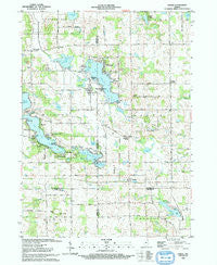
~ Stroh IN topo map, 1:24000 scale, 7.5 X 7.5 Minute, Historical, 1993, updated 1993
Stroh, Indiana, USGS topographic map dated 1993.
Includes geographic coordinates (latitude and longitude). This topographic map is suitable for hiking, camping, and exploring, or framing it as a wall map.
Printed on-demand using high resolution imagery, on heavy weight and acid free paper, or alternatively on a variety of synthetic materials.
Topos available on paper, Waterproof, Poly, or Tyvek. Usually shipping rolled, unless combined with other folded maps in one order.
- Product Number: USGS-5288344
- Free digital map download (high-resolution, GeoPDF): Stroh, Indiana (file size: 11 MB)
- Map Size: please refer to the dimensions of the GeoPDF map above
- Weight (paper map): ca. 55 grams
- Map Type: POD USGS Topographic Map
- Map Series: HTMC
- Map Verison: Historical
- Cell ID: 43505
- Scan ID: 156137
- Imprint Year: 1993
- Woodland Tint: Yes
- Aerial Photo Year: 1990
- Edit Year: 1993
- Field Check Year: 1991
- Datum: NAD83
- Map Projection: Universal Transverse Mercator
- Map published by United States Geological Survey
- Map Language: English
- Scanner Resolution: 600 dpi
- Map Cell Name: Stroh
- Grid size: 7.5 X 7.5 Minute
- Date on map: 1993
- Map Scale: 1:24000
- Geographical region: Indiana, United States
Neighboring Maps:
All neighboring USGS topo maps are available for sale online at a variety of scales.
Spatial coverage:
Topo map Stroh, Indiana, covers the geographical area associated the following places:
- Stroh - Lakeview - Helmer - Westview - Lakeside Park - Gravel Beach - Oak Lodge - Indian Hills - Mount Pisgah - Hartzel - Elmira - Woodland Park - Shady Nook - Timberhurst - Tall Timbers - Turkey Creek - Wildwood - Sha-Get Acres - Indianola - Salem Center - Greenwood - Ramblewood - Meadow Shores Park
- Map Area ID: AREA41.62541.5-85.25-85.125
- Northwest corner Lat/Long code: USGSNW41.625-85.25
- Northeast corner Lat/Long code: USGSNE41.625-85.125
- Southwest corner Lat/Long code: USGSSW41.5-85.25
- Southeast corner Lat/Long code: USGSSE41.5-85.125
- Northern map edge Latitude: 41.625
- Southern map edge Latitude: 41.5
- Western map edge Longitude: -85.25
- Eastern map edge Longitude: -85.125


