
~ Kelsey Peak OR topo map, 1:24000 scale, 7.5 X 7.5 Minute, Historical, 2011
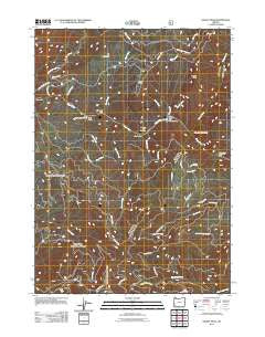
Kelsey Peak, Oregon, USGS topographic map dated 2011.
Includes geographic coordinates (latitude and longitude). This topographic map is suitable for hiking, camping, and exploring, or framing it as a wall map.
Printed on-demand using high resolution imagery, on heavy weight and acid free paper, or alternatively on a variety of synthetic materials.
Topos available on paper, Waterproof, Poly, or Tyvek. Usually shipping rolled, unless combined with other folded maps in one order.
- Product Number: USGS-5284080
- Free digital map download (high-resolution, GeoPDF): Kelsey Peak, Oregon (file size: 28 MB)
- Map Size: please refer to the dimensions of the GeoPDF map above
- Weight (paper map): ca. 55 grams
- Map Type: POD USGS Topographic Map
- Map Series: US Topo
- Map Verison: Historical
- Cell ID: 23209
- Datum: North American Datum of 1983
- Map Projection: Transverse Mercator
- Map Cell Name: Kelsey Peak
- Grid size: 7.5 X 7.5 Minute
- Date on map: 2011
- Map Scale: 1:24000
- Geographical region: Oregon, United States
Neighboring Maps:
All neighboring USGS topo maps are available for sale online at a variety of scales.
Spatial coverage:
Topo map Kelsey Peak, Oregon, covers the geographical area associated the following places:
- Slide Creek - Big Meadows - Dulog Creek Recreation Area - Johns Riffle - Ditch Creek - Winkle Bar Airport - Long Gulch - Battle Bar Recreation Area - Missouri Bar - Corral Creek - Winkle Bar Riffle - Dulog Creek - Hewitt Creek Recreation Site - Trout Creek - Kelsy Creek Campground - Bear Camp Viewpoint Recreation Site - Venner Creek - Bald Ridge - Battle Bar - Big Boulder Rapids - Maggies Riffle - Missouri Creek - Long Gulch Riffle - Paradise Creek - East Fork Hewitt Creek - Kelsey Falls (historical) - West Fork Mule Creek - Hewitt Creek - Battle Bar Riffle - China Bar - Island Rapids - Kelsey Creek - East Fork Kelsey Creek - Ditch Creek Recreation Site - Kelsey Peak - Quail Creek - Long Gulch Recreation Area - Fort Lamerick (historical) - Dulog Riffle - Winkle Bar
- Map Area ID: AREA42.7542.625-123.875-123.75
- Northwest corner Lat/Long code: USGSNW42.75-123.875
- Northeast corner Lat/Long code: USGSNE42.75-123.75
- Southwest corner Lat/Long code: USGSSW42.625-123.875
- Southeast corner Lat/Long code: USGSSE42.625-123.75
- Northern map edge Latitude: 42.75
- Southern map edge Latitude: 42.625
- Western map edge Longitude: -123.875
- Eastern map edge Longitude: -123.75


