
~ Eight Dollar Mountain OR topo map, 1:24000 scale, 7.5 X 7.5 Minute, Historical, 2011
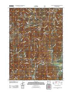
Eight Dollar Mountain, Oregon, USGS topographic map dated 2011.
Includes geographic coordinates (latitude and longitude). This topographic map is suitable for hiking, camping, and exploring, or framing it as a wall map.
Printed on-demand using high resolution imagery, on heavy weight and acid free paper, or alternatively on a variety of synthetic materials.
Topos available on paper, Waterproof, Poly, or Tyvek. Usually shipping rolled, unless combined with other folded maps in one order.
- Product Number: USGS-5284072
- Free digital map download (high-resolution, GeoPDF): Eight Dollar Mountain, Oregon (file size: 27 MB)
- Map Size: please refer to the dimensions of the GeoPDF map above
- Weight (paper map): ca. 55 grams
- Map Type: POD USGS Topographic Map
- Map Series: US Topo
- Map Verison: Historical
- Cell ID: 13769
- Datum: North American Datum of 1983
- Map Projection: Transverse Mercator
- Map Cell Name: Eight Dollar Mountain
- Grid size: 7.5 X 7.5 Minute
- Date on map: 2011
- Map Scale: 1:24000
- Geographical region: Oregon, United States
Neighboring Maps:
All neighboring USGS topo maps are available for sale online at a variety of scales.
Spatial coverage:
Topo map Eight Dollar Mountain, Oregon, covers the geographical area associated the following places:
- Serpentine Point - Kerby Flat - Squaw Ridge - Ellis Creek - Hoover Gulch - Mikes Gulch - Anderson Mine - Bour Post Office (historical) - Spring Creek - Deer Creek - Spalding Pond Recreation Site - Alder Gulch - Horse Creek - Pockett Knoll - Squaw Creek - Clear Creek - Eight Dollar Mountain Creek - Eight Dollar Mountain - East Fork Squaw Creek - Shade Creek - Fayes Gulch - Gold Blanket Mine - Cedar Gulch - Coonskin - Spaulding Mill - West Fork Squaw Creek - Little Sixmile Creek - Baldwin Gulch - Squaw Mountain - Star Flat - Wheeler City (historical) - Lookout Gap - Snailback Creek - Zigzag Creek - Sixmile Creek
- Map Area ID: AREA42.37542.25-123.75-123.625
- Northwest corner Lat/Long code: USGSNW42.375-123.75
- Northeast corner Lat/Long code: USGSNE42.375-123.625
- Southwest corner Lat/Long code: USGSSW42.25-123.75
- Southeast corner Lat/Long code: USGSSE42.25-123.625
- Northern map edge Latitude: 42.375
- Southern map edge Latitude: 42.25
- Western map edge Longitude: -123.75
- Eastern map edge Longitude: -123.625


