
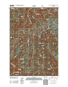
~ Bagby Hot Springs OR topo map, 1:24000 scale, 7.5 X 7.5 Minute, Historical, 2011
Bagby Hot Springs, Oregon, USGS topographic map dated 2011.
Includes geographic coordinates (latitude and longitude). This topographic map is suitable for hiking, camping, and exploring, or framing it as a wall map.
Printed on-demand using high resolution imagery, on heavy weight and acid free paper, or alternatively on a variety of synthetic materials.
Topos available on paper, Waterproof, Poly, or Tyvek. Usually shipping rolled, unless combined with other folded maps in one order.
- Product Number: USGS-5284022
- Free digital map download (high-resolution, GeoPDF): Bagby Hot Springs, Oregon (file size: 28 MB)
- Map Size: please refer to the dimensions of the GeoPDF map above
- Weight (paper map): ca. 55 grams
- Map Type: POD USGS Topographic Map
- Map Series: US Topo
- Map Verison: Historical
- Cell ID: 2112
- Datum: North American Datum of 1983
- Map Projection: Transverse Mercator
- Map Cell Name: Bagby Hot Springs
- Grid size: 7.5 X 7.5 Minute
- Date on map: 2011
- Map Scale: 1:24000
- Geographical region: Oregon, United States
Neighboring Maps:
All neighboring USGS topo maps are available for sale online at a variety of scales.
Spatial coverage:
Topo map Bagby Hot Springs, Oregon, covers the geographical area associated the following places:
- Whetstone Trail - Baty Butte - East Mountain Trail - Baty Silver King Trail - Perry Creek - Hughs Horse Gravel Pit - Ora Creek - Skookum Lake Campground - Bagby Natural Research Area - Shower Creek - Betty Creek - Bagby Hot Springs Guard Station - Lost Creek Meadow - Spray Creek - Opal Creek Wilderness - Nohorn Trail - South Fork Mountain Trail - Pal Creek - Skin Creek - Blister Creek - Doris Creek - Bagby Hot Springs Recreation Site - Whetstone Creek - Joyce Lake - Thunder Mountain - Skookum Lake - Pegleg Falls - Pegleg Falls Recreation Site - Stroupe Creek Quarry - Hugh Creek Quarry - Hugh Creek - Stroupe Creek - Peggy Creek - Molalla Trail - Pin Creek - Pansy Creek - Alice Creek - Bagby Hot Springs - Rock Creek - Nohorn Creek
- Map Area ID: AREA4544.875-122.25-122.125
- Northwest corner Lat/Long code: USGSNW45-122.25
- Northeast corner Lat/Long code: USGSNE45-122.125
- Southwest corner Lat/Long code: USGSSW44.875-122.25
- Southeast corner Lat/Long code: USGSSE44.875-122.125
- Northern map edge Latitude: 45
- Southern map edge Latitude: 44.875
- Western map edge Longitude: -122.25
- Eastern map edge Longitude: -122.125


