
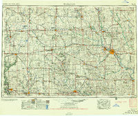
~ Waterloo IA topo map, 1:250000 scale, 1 X 2 Degree, Historical, 1955
Waterloo, Iowa, USGS topographic map dated 1955.
Includes geographic coordinates (latitude and longitude). This topographic map is suitable for hiking, camping, and exploring, or framing it as a wall map.
Printed on-demand using high resolution imagery, on heavy weight and acid free paper, or alternatively on a variety of synthetic materials.
Topos available on paper, Waterproof, Poly, or Tyvek. Usually shipping rolled, unless combined with other folded maps in one order.
- Product Number: USGS-5283863
- Free digital map download (high-resolution, GeoPDF): Waterloo, Iowa (file size: 14 MB)
- Map Size: please refer to the dimensions of the GeoPDF map above
- Weight (paper map): ca. 55 grams
- Map Type: POD USGS Topographic Map
- Map Series: HTMC
- Map Verison: Historical
- Cell ID: 69088
- Scan ID: 175698
- Woodland Tint: Yes
- Aerial Photo Year: 1950
- Field Check Year: 1954
- Datum: Unstated
- Map Projection: Transverse Mercator
- Map published by United States Army Corps of Engineers
- Map published by United States Army
- Map Language: English
- Scanner Resolution: 600 dpi
- Map Cell Name: Waterloo
- Grid size: 1 X 2 Degree
- Date on map: 1955
- Map Scale: 1:250000
- Geographical region: Iowa, United States
Neighboring Maps:
All neighboring USGS topo maps are available for sale online at a variety of scales.
Spatial coverage:
Topo map Waterloo, Iowa, covers the geographical area associated the following places:
- Big Rock - Butler Center - Rockwell - Powersville - Alden Station (historical) - Kanawha - Burdette - Kamrar - Moingona - Boies - Kesley - Saint Anthony - Fernald - Mooreville (historical) - Olaf - Sumner - Dresden - Robertson - Rough Woods Hill - Aplington - Bloomington - Richfield - Secor (historical) - Union - New Providence - Coulter - Alpha - Buckingham (historical) - Dairyville - Prairie View Acres Mobile Home Park - Rosedale - Artesian - Seigel - Parkersburg - Iowa Falls - Gifford - Starlite Mobile Home Park - Cedar City - Mackey - Hilltop - Racine - Fairbank - Waverly Junction - Southview Estates Mobile Home Park - Wilmar - Janesville - Conrad - Geneva - Rowan - High Acres Mobile Home Park - Zaneta - Mount Auburn - Bristow - Horton - Corwith - Shady Grove - Blessing - Williamstown - Buckeye - Edwards (historical) - Liscomb - Klinger - Van Horne - Alexander - Popejoy - Oakland - Eleanor - Illinois Grove - Meadow Lane Mobile Home Park - Griffen - Jubilee - Bremer - Glasgow (historical) - North Cedar - Roland - Rogersville - LaMoille - Ivester - Cedar Falls - Littleton - Stanhope - Garrison - Ames - Raymond - Rockton - Frederika - Albion - Geneva - Xenia - Jewell - North Street Mobile Home Park - Blairsburg - Lear - Raymar - Country Aire Mobile Home Park - Swaledale - Finchford - Dumont - Dysart - Brandon
- Map Area ID: AREA4342-94-92
- Northwest corner Lat/Long code: USGSNW43-94
- Northeast corner Lat/Long code: USGSNE43-92
- Southwest corner Lat/Long code: USGSSW42-94
- Southeast corner Lat/Long code: USGSSE42-92
- Northern map edge Latitude: 43
- Southern map edge Latitude: 42
- Western map edge Longitude: -94
- Eastern map edge Longitude: -92


