
~ Sioux City IA topo map, 1:250000 scale, 1 X 2 Degree, Historical, 1955, updated 1976
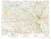
Sioux City, Iowa, USGS topographic map dated 1955.
Includes geographic coordinates (latitude and longitude). This topographic map is suitable for hiking, camping, and exploring, or framing it as a wall map.
Printed on-demand using high resolution imagery, on heavy weight and acid free paper, or alternatively on a variety of synthetic materials.
Topos available on paper, Waterproof, Poly, or Tyvek. Usually shipping rolled, unless combined with other folded maps in one order.
- Product Number: USGS-5283859
- Free digital map download (high-resolution, GeoPDF): Sioux City, Iowa (file size: 16 MB)
- Map Size: please refer to the dimensions of the GeoPDF map above
- Weight (paper map): ca. 55 grams
- Map Type: POD USGS Topographic Map
- Map Series: HTMC
- Map Verison: Historical
- Cell ID: 69032
- Scan ID: 175546
- Imprint Year: 1976
- Woodland Tint: Yes
- Edit Year: 1966
- Field Check Year: 1955
- Datum: Unstated
- Map Projection: Transverse Mercator
- Map published by United States Geological Survey
- Map Language: English
- Scanner Resolution: 600 dpi
- Map Cell Name: Sioux City
- Grid size: 1 X 2 Degree
- Date on map: 1955
- Map Scale: 1:250000
- Geographical region: Iowa, United States
Neighboring Maps:
All neighboring USGS topo maps are available for sale online at a variety of scales.
Spatial coverage:
Topo map Sioux City, Iowa, covers the geographical area associated the following places:
- Decatur - Leeds - West Randolph (historical) - Pender - Napa Junction - Brunsville - Marshalltown (historical) - Valleyview - Nora - Plymouth (historical) - Evergreen Village - Vermillion - Bon Homme Colony - Lodi - Saybrook (historical) - Waterbury - Midland - Basford (historical) - Nacora - Wren - McLean - Owego - Plainview - Ruble - Goodwin - O'Leary - Fordyce - Glen Ellen - Coleridge - Junction City - McNally - Oyens - Hoffmans Trailer Court - Saint Johns Trailer Court - Maskell - Spink - Northshore Development - Merrill - Hub City - Pleasant Valley - Volin - Le Mars - Bluff Center (historical) - Aten - Westfield - Yeomans - Struble - North Shore - Thurston - Seney - Martinsburg - Laurel - Wee Town - Norfolk - Wynot - Emmet - South Yankton - Hawarden - Big Springs - Hoskins - Pierce - Riverside - Hornick - Crathorne - Clay Point - Akron - Adaville - Lindy - Mammen - Lake Village Trailer Court - Hadar - Millis Beach - Burbank - Mount Lucia - Saint Helena - Lembke Landing - East End Tailer Court - Winside - Ponca - Santee - Rosalie - Creighton - Gayville - Luton - Chatsworth - Wayne - Magnet - Carnes - Parkview Terrace - Pilger - Running Water - James - Lakeport - Potosia - Lime Grove - Freeway Homes - Menominee - Wakefield - Tilden - Shady Elm Trailer Court
- Map Area ID: AREA4342-98-96
- Northwest corner Lat/Long code: USGSNW43-98
- Northeast corner Lat/Long code: USGSNE43-96
- Southwest corner Lat/Long code: USGSSW42-98
- Southeast corner Lat/Long code: USGSSE42-96
- Northern map edge Latitude: 43
- Southern map edge Latitude: 42
- Western map edge Longitude: -98
- Eastern map edge Longitude: -96


