
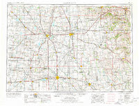
~ Mason City IA topo map, 1:250000 scale, 1 X 2 Degree, Historical, 1954, updated 1978
Mason City, Iowa, USGS topographic map dated 1954.
Includes geographic coordinates (latitude and longitude). This topographic map is suitable for hiking, camping, and exploring, or framing it as a wall map.
Printed on-demand using high resolution imagery, on heavy weight and acid free paper, or alternatively on a variety of synthetic materials.
Topos available on paper, Waterproof, Poly, or Tyvek. Usually shipping rolled, unless combined with other folded maps in one order.
- Product Number: USGS-5283853
- Free digital map download (high-resolution, GeoPDF): Mason City, Iowa (file size: 14 MB)
- Map Size: please refer to the dimensions of the GeoPDF map above
- Weight (paper map): ca. 55 grams
- Map Type: POD USGS Topographic Map
- Map Series: HTMC
- Map Verison: Historical
- Cell ID: 68895
- Scan ID: 175112
- Imprint Year: 1978
- Woodland Tint: Yes
- Aerial Photo Year: 1974
- Edit Year: 1976
- Field Check Year: 1954
- Datum: Unstated
- Map Projection: Transverse Mercator
- Map published by United States Geological Survey
- Map Language: English
- Scanner Resolution: 600 dpi
- Map Cell Name: Mason City
- Grid size: 1 X 2 Degree
- Date on map: 1954
- Map Scale: 1:250000
- Geographical region: Iowa, United States
Neighboring Maps:
All neighboring USGS topo maps are available for sale online at a variety of scales.
Spatial coverage:
Topo map Mason City, Iowa, covers the geographical area associated the following places:
- Lawler - Steele Center - Predmore - Preston Mobile Home Park - Navan - Lerdal - Hayfield - Renova - Saratoga - Ziemer's Mobile Home Park - Orchard - Riceville (historical) - Saude - Wykoff Mobile Home Park I - Thompson - McIntire - Brownville - Green Meadows Mobile Home Park - Carpenter - Bolan - Nicolville - Freiheit Spring - Bailey - Fountain - Devon - Hartland - Schley - Waucoma - Roseville - Stewartville - Murtaugh - Dexter - Bonair - Forestville - Otranto - Shady Acre Mobile Home Park - Carimona - Lime Springs - Hurley - Central Heights - Bucksnort - Big Spring - Hillcrest Mobile Home Park - Midway - Stacyville - Pleasant Grove - Fertile - Meadow Mobile Home Park - Taopi - Willow Ridge Mobile Home Park - Rock Creek - Vista Village Mobile Home Park - Vernon Springs - Washington - Etna - Mansfield - Emery - Waltham - Forest Park Mobile Home Court - Saint Ansgar - Westfield Center (historical) - Owen - Cherry Grove - Walters - New Richland - Forest City (historical) - Manly - Burchinal - Ventura Heights - Shanty Town - Somber - Howardville - Duncan - Rainbow Terrace Mobile Home Park - Nora Junction - North Washington - Countryside Mobile Home Park - Plymouth - Leland - Nilesville - Meltonville - Protivin - Armstrong - Cummingsville - Florenceville - Petran - Vista - River Point - Union - Frost - Lakeview Mobile Home Park - Bristol - Sigsbee - Varco - Rock Dell - Rudd - Plymouth Junction - Matawan - Stacyville Junction - Myrtle
- Map Area ID: AREA4443-94-92
- Northwest corner Lat/Long code: USGSNW44-94
- Northeast corner Lat/Long code: USGSNE44-92
- Southwest corner Lat/Long code: USGSSW43-94
- Southeast corner Lat/Long code: USGSSE43-92
- Northern map edge Latitude: 44
- Southern map edge Latitude: 43
- Western map edge Longitude: -94
- Eastern map edge Longitude: -92


