
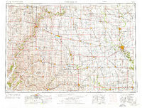
~ Fort Dodge IA topo map, 1:250000 scale, 1 X 2 Degree, Historical, 1954, updated 1976
Fort Dodge, Iowa, USGS topographic map dated 1954.
Includes geographic coordinates (latitude and longitude). This topographic map is suitable for hiking, camping, and exploring, or framing it as a wall map.
Printed on-demand using high resolution imagery, on heavy weight and acid free paper, or alternatively on a variety of synthetic materials.
Topos available on paper, Waterproof, Poly, or Tyvek. Usually shipping rolled, unless combined with other folded maps in one order.
- Product Number: USGS-5283847
- Free digital map download (high-resolution, GeoPDF): Fort Dodge, Iowa (file size: 15 MB)
- Map Size: please refer to the dimensions of the GeoPDF map above
- Weight (paper map): ca. 55 grams
- Map Type: POD USGS Topographic Map
- Map Series: HTMC
- Map Verison: Historical
- Cell ID: 68783
- Scan ID: 174683
- Imprint Year: 1976
- Woodland Tint: Yes
- Aerial Photo Year: 1974
- Edit Year: 1974
- Field Check Year: 1954
- Datum: Unstated
- Map Projection: Transverse Mercator
- Map published by United States Geological Survey
- Map Language: English
- Scanner Resolution: 600 dpi
- Map Cell Name: Fort Dodge
- Grid size: 1 X 2 Degree
- Date on map: 1954
- Map Scale: 1:250000
- Geographical region: Iowa, United States
Neighboring Maps:
All neighboring USGS topo maps are available for sale online at a variety of scales.
Spatial coverage:
Topo map Fort Dodge, Iowa, covers the geographical area associated the following places:
- Cushing - Hart - Vista Estates Mobile Home Park - Pierson - Rolfe - Cypsum City (historical) - Laurens - Dayton - Maple River - Easley - Carnarvon - Bradgate - Lohrville - Deloit - Galbraith - Smithland - Schleswig - Kingsley - Sulphur Springs - Lizard (historical) - Thor - Lanyon - Kiron - Lytton - Charter Oak - Manson - Clare - Lake City - Peterson - Shady Oak - Hanna - Ralston - Kentner - Sioux Rapids - Brogan (historical) - Coalville - Germantown - Saint Joseph - Boyer River - Lucky Valley (historical) - Lena - Hanover - Piper - Denison - Lidderdale - Holstein - Waterman - Farnhamville - Beaver - Grand Junction - Sac City Junction (historical) - Stein's Rockin R Mobile Home Park - Ridotto - Havelock - Knierim - Lundgren - Linn Grove - Mary Hill - Cornell - Palmer - West Bend - Boxholm - Grant City - Tara - Larrabee - Sutherland - Gilmore City - Lakeview - Albert City - Webb - Ute - Newell - Humboldt - Dana - Fort Dodge - Castana - Lakeside - Varina - Rands - Churdan - Carroll Community Estates - Yetter - Halbur - Meriden - Vincent - Storm Lake - Moorland - Lanesboro - Danbury - Rubens Siding - Lavinia - Blanden - Kalo - Onawa Junction - Remsen - Lake View - Rodney - Vail - Elkton - Westside
- Map Area ID: AREA4342-96-94
- Northwest corner Lat/Long code: USGSNW43-96
- Northeast corner Lat/Long code: USGSNE43-94
- Southwest corner Lat/Long code: USGSSW42-96
- Southeast corner Lat/Long code: USGSSE42-94
- Northern map edge Latitude: 43
- Southern map edge Latitude: 42
- Western map edge Longitude: -96
- Eastern map edge Longitude: -94


