
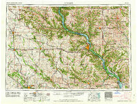
~ Dubuque IA topo map, 1:250000 scale, 1 X 2 Degree, Historical, 1962, updated 1962
Dubuque, Iowa, USGS topographic map dated 1962.
Includes geographic coordinates (latitude and longitude). This topographic map is suitable for hiking, camping, and exploring, or framing it as a wall map.
Printed on-demand using high resolution imagery, on heavy weight and acid free paper, or alternatively on a variety of synthetic materials.
Topos available on paper, Waterproof, Poly, or Tyvek. Usually shipping rolled, unless combined with other folded maps in one order.
- Product Number: USGS-5283837
- Free digital map download (high-resolution, GeoPDF): Dubuque, Iowa (file size: 17 MB)
- Map Size: please refer to the dimensions of the GeoPDF map above
- Weight (paper map): ca. 55 grams
- Map Type: POD USGS Topographic Map
- Map Series: HTMC
- Map Verison: Historical
- Cell ID: 68757
- Scan ID: 174551
- Imprint Year: 1962
- Woodland Tint: Yes
- Visual Version Number: 1
- Field Check Year: 1958
- Datum: Unstated
- Map Projection: Transverse Mercator
- Map published by United States Geological Survey
- Map published by United States Army Corps of Engineers
- Map published by United States Army
- Map Language: English
- Scanner Resolution: 600 dpi
- Map Cell Name: Dubuque
- Grid size: 1 X 2 Degree
- Date on map: 1962
- Map Scale: 1:250000
- Geographical region: Iowa, United States
Neighboring Maps:
All neighboring USGS topo maps are available for sale online at a variety of scales.
Spatial coverage:
Topo map Dubuque, Iowa, covers the geographical area associated the following places:
- Bankston - Guttenberg - Samoa - Argand - Martelle - Georgetown - Maynard - Wacker - Viola - Center Hill - Bennettsville - Lakeview Mobile Home Court - Cameron - Hazleton - Vista - Onslow - McCartney - Millrock - Colesburg - Mineral Point - Andrew - Manatheka (historical) - Bremen - Central City - Benton City (historical) - Woodbine - Blanding - Manchester - Buena Vista - Rodden - Paris (historical) - Shady Dell - Rockville - Littleport - Langworthy - Hurstville - Hickory Grove - Bagley - Temple Hill - Thorpe - Highland - La Motte - Browns - York - Ozark - Lamont - Preston - Menominee - Elk Grove - Millville - Rockaway (historical) - Fairview - Jenkinsville - Epworth - Annaton - Midway - Northend Mobile Home Park - Marion Mobile Home Park - Thomasville - Paris - Eden - Blackhawk - Lore - Bryantsburg - Saint Rose - Sinsinawa - Beetown - Almoral Siding (historical) - Ehler - Bellevue - Wood - Shellsburg - Etna - Rowley - Palo - White Oak - Stone City - Benton - Fennimore - Elmo - Flora Fountain - Spragueville - Fairview - Millbrig (historical) - Council Hill - Cass - Knapp Mobile Home Park - Orchard Lane Mobile Home Court - Rockville - Ayers - Fulton - Cottage Hill - Arthur - Eckards - Winthrop - Twin T Mobile Home Park - Weston (historical) - Aiken - Teeds Grove - Waupeton
- Map Area ID: AREA4342-92-90
- Northwest corner Lat/Long code: USGSNW43-92
- Northeast corner Lat/Long code: USGSNE43-90
- Southwest corner Lat/Long code: USGSSW42-92
- Southeast corner Lat/Long code: USGSSE42-90
- Northern map edge Latitude: 43
- Southern map edge Latitude: 42
- Western map edge Longitude: -92
- Eastern map edge Longitude: -90


