
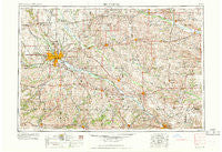
~ Des Moines IA topo map, 1:250000 scale, 1 X 2 Degree, Historical, 1969
Des Moines, Iowa, USGS topographic map dated 1969.
Includes geographic coordinates (latitude and longitude). This topographic map is suitable for hiking, camping, and exploring, or framing it as a wall map.
Printed on-demand using high resolution imagery, on heavy weight and acid free paper, or alternatively on a variety of synthetic materials.
Topos available on paper, Waterproof, Poly, or Tyvek. Usually shipping rolled, unless combined with other folded maps in one order.
- Product Number: USGS-5283829
- Free digital map download (high-resolution, GeoPDF): Des Moines, Iowa (file size: 17 MB)
- Map Size: please refer to the dimensions of the GeoPDF map above
- Weight (paper map): ca. 55 grams
- Map Type: POD USGS Topographic Map
- Map Series: HTMC
- Map Verison: Historical
- Cell ID: 68746
- Scan ID: 174506
- Woodland Tint: Yes
- Aerial Photo Year: 1950
- Field Check Year: 1954
- Datum: Unstated
- Map Projection: Transverse Mercator
- Map published by United States Geological Survey
- Map Language: English
- Scanner Resolution: 600 dpi
- Map Cell Name: Des Moines
- Grid size: 1 X 2 Degree
- Date on map: 1969
- Map Scale: 1:250000
- Geographical region: Iowa, United States
Neighboring Maps:
All neighboring USGS topo maps are available for sale online at a variety of scales.
Spatial coverage:
Topo map Des Moines, Iowa, covers the geographical area associated the following places:
- Redman (historical) - Van - Willows Mobile Home Court - Indian Ridge Mobile Home Park - Phillips - Highland Center - Eveland - Stover Heights Community - Sunny-Brook Mobile Home Park - Crestwood - Barnes City - Regency Manor Mobile Home Park - Killduff - Sigourney - Cedar - McBride - Pershing - Harper - Wolf Lake Addition - Abingdon - Pickering - Williamson - Bernhart - Brooklyn - Greenbush - Prole - Highview Mobile Home Park - Spring Hill - Ewart - Otley - Scotch Ridge - Timber Valley Mobile Home Park - Ferguson - Irving - Creswell - Ivy - Farson - Colfax - University Park - Windsor Heights - Willard - Norwalk - The Meadows - Xenia - Keb (historical) - Campbell - Blairstown - Lynnville - Norwoodville - Givin - Tama - Ioka (historical) - Altoona - Dillon - Orilla - Clarkson (historical) - Consol - Lacona - Fort Des Moines - State Center Junction - Jay - Loring - Brownsville - Rosetta (historical) - Beech - Munterville - Goddard - Midvale - Dudley - Granger Homesteads - Bussey - Ward - Arbor Lake Mobile Home Community - Hanley - Coal Creek - Herrold - Metz - Olmitz - Carnforth - New Sharon - North American Trailer Park - Wright - Ollie - Cloud - Webster - Milo - Pleasant Valley Mobile Home Park - Pickwick - Woodland Hills - Toledo - Andrew Mobile Home Park - Eddyville - New Virginia - Capitol Heights - Paradise Mobile Home Park - Adelphi - Malcom - Liberty Center - Pekin - Lawrenceburg
- Map Area ID: AREA4241-94-92
- Northwest corner Lat/Long code: USGSNW42-94
- Northeast corner Lat/Long code: USGSNE42-92
- Southwest corner Lat/Long code: USGSSW41-94
- Southeast corner Lat/Long code: USGSSE41-92
- Northern map edge Latitude: 42
- Southern map edge Latitude: 41
- Western map edge Longitude: -94
- Eastern map edge Longitude: -92


