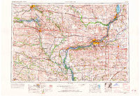
~ Davenport IA topo map, 1:250000 scale, 1 X 2 Degree, Historical, 1958, updated 1968
Davenport, Iowa, USGS topographic map dated 1958.
Includes geographic coordinates (latitude and longitude). This topographic map is suitable for hiking, camping, and exploring, or framing it as a wall map.
Printed on-demand using high resolution imagery, on heavy weight and acid free paper, or alternatively on a variety of synthetic materials.
Topos available on paper, Waterproof, Poly, or Tyvek. Usually shipping rolled, unless combined with other folded maps in one order.
- Product Number: USGS-5283823
- Free digital map download (high-resolution, GeoPDF): Davenport, Iowa (file size: 16 MB)
- Map Size: please refer to the dimensions of the GeoPDF map above
- Weight (paper map): ca. 55 grams
- Map Type: POD USGS Topographic Map
- Map Series: HTMC
- Map Verison: Historical
- Cell ID: 68740
- Scan ID: 174437
- Imprint Year: 1968
- Woodland Tint: Yes
- Edit Year: 1967
- Field Check Year: 1958
- Datum: Unstated
- Map Projection: Transverse Mercator
- Map published by United States Geological Survey
- Map Language: English
- Scanner Resolution: 600 dpi
- Map Cell Name: Davenport
- Grid size: 1 X 2 Degree
- Date on map: 1958
- Map Scale: 1:250000
- Geographical region: Iowa, United States
Neighboring Maps:
All neighboring USGS topo maps are available for sale online at a variety of scales.
Spatial coverage:
Topo map Davenport, Iowa, covers the geographical area associated the following places:
- North Liberty - Nira - Hometown-Cedar Terrace - Henderson Grove - Reynolds - Ayresville - Colonial Estates Mobile Home Park - Oxford (historical) - Aledo - Washington - Argo - Sunbeam - Elk River Junction - Ely - West Chester - Ogle - Oxford Mills - New Dixon - Rochester - Osborn - Cairo - Oakville - Atalissa - Green Rock - Newport - Marsh - Thomson - East Rapids - Ponderosa Park Mobile Home Park - Nekoma - Sherton Heights - Nahant - Rustic Ridge Mobile Home Park - Wassonville (historical) - West Branch Mobile Home Village - Riverdale - Ainsworth - Gambrill (historical) - Sunny Hill Estates - Eliza - Great Oaks - Spring Valley - Walnut Grove - Union Grove - Oxford - West Amana - Mount Vernon - Dakota Mobile Home Park - Buffalo - Walcott Eststes - Country Aire Home Park - Cosgrove - Fairport - Clinton - Milan - Bertram - Jamestown - Crawfordsville - Bethel - Gingle Corners - Winfield - Haskins - Bridgeway Addition - Middle Amana - Brighton - Clarence - Stanwood - Donahue - Hills - Iowa Junction (historical) - Rapids City - Poplar Grove - Frytown - Letts - Perlee - Hickory Hills - West Liberty - North Henderson - Columbus City - Sikkemas Trailer Park - Hillsboro (historical) - Centerville - Noble - Hickory Grove - New Boston - Vernon Heights Mobile Home Park - Vernon View - Camanche - Lakewood Park - Woodhull - Cedar Brook - Morning Sun - Summit View Mobile Home Park - Downey - Grandview - Conesville - Millersburg - Black Hawk - Dayfield - Hickory Grove Mobile Home Park
- Map Area ID: AREA4241-92-90
- Northwest corner Lat/Long code: USGSNW42-92
- Northeast corner Lat/Long code: USGSNE42-90
- Southwest corner Lat/Long code: USGSSW41-92
- Southeast corner Lat/Long code: USGSSE41-90
- Northern map edge Latitude: 42
- Southern map edge Latitude: 41
- Western map edge Longitude: -92
- Eastern map edge Longitude: -90

